Back Arcu volcánicu centroamericanu AST Mərkəzi Amerika vulkanlarının siyahısı Azerbaijani Arco volcánico centroamericano Spanish کمان آتشفشانی آمریکای مرکزی Persian Keski-Amerikan vulkaaninen kaari Finnish Arc volcanique d'Amérique centrale French Կենտրոնական Ամերիկայի հրաբուխներ Armenian Arco vulcanico dell'America centrale Italian Centraal-Amerikaanse vulkanische boog Dutch Arco vulcânico da América Central Portuguese

| Part of a series on |
| Central America |
|---|
 |
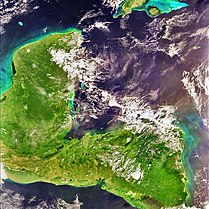
The Central American Volcanic Arc (often abbreviated to CAVA) is a chain of volcanoes which extends parallel to the Pacific coastline of the Central American Isthmus, from Mexico to Panama. This volcanic arc, which has a length of 1,100 kilometers (680 mi)[1][2] is formed by an active subduction zone, with the Cocos Plate subducting underneath the Caribbean Plate.[3] The region has been volcanically and geologically active for at least the past several million years. Numerous volcanoes are spread throughout various Central American countries; many have been active in the geologic past, some more so than others.
- ^ Rose, W., Conway, F., Pullinger, C., Deino, A. and McIntosh, W., 1999. An improved age framework for late Quaternary silicic eruptions in northern Central America. Bulletin of Volcanology, 61(1-2), pp.106-120.
- ^ Whattam, S. and Stern, R., 2015. Arc magmatic evolution and the construction of continental crust at the Central American Volcanic Arc system. International Geology Review, 58(6), pp.653-686.
- ^ Álvarez-Gómez, J., Meijer, P., Martínez-Díaz, J. and Capote, R., 2008. Constraints from finite element modeling on the active tectonics of northern Central America and the Middle America Trench. Tectonics, 27(1)
© MMXXIII Rich X Search. We shall prevail. All rights reserved. Rich X Search