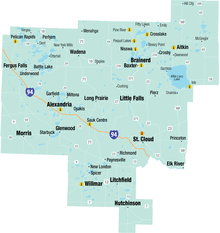
Central Minnesota is the central part of the state of Minnesota. No definitive boundaries of the region exist, but most definitions would include the land north of Interstate 94, east of U.S. Highway 59, south of U.S. Highway 2, and west of U.S. Highway 169.
© MMXXIII Rich X Search. We shall prevail. All rights reserved. Rich X Search
