Back Cerignola AN تشيرينيولا Arabic Cerignola AVK Çerinyola Azerbaijani چرینیولا AZB Чэле-дзі-Сан-Віта Byelorussian Чериньола Bulgarian Cerignola Breton Cerignola Catalan Чериньола CE
Cerignola | |
|---|---|
| Comune di Cerignola | |
 Chiesa del Carmine in Cerignola | |
 Cerignola within the Province of Foggia | |
| Coordinates: 41°16′N 15°54′E / 41.267°N 15.900°E | |
| Country | Italy |
| Region | Apulia |
| Province | Foggia (FG) |
| Frazioni | Angeloni, Borgo Libertà, Borgo Tressanti, Cerignola Campagna, La Pila, Montaltino, Moschella, Posta Incorvera, Posta Uccello, Pozzo Terraneo, Salice, San Giovanni in Fonte, San Michele delle Vigne, Tannioa |
| Government | |
| • Mayor | Francesco Bonito |
| Area | |
| • Total | 593.71 km2 (229.23 sq mi) |
| Elevation | 120 m (390 ft) |
| Population (30 November 2017)[2] | |
| • Total | 58,534 |
| • Density | 99/km2 (260/sq mi) |
| Demonym | Cerignolani |
| Time zone | UTC+1 (CET) |
| • Summer (DST) | UTC+2 (CEST) |
| Postal code | 71042 |
| Dialing code | 0885 |
| Patron saint | Madonna of Ripalta |
| Saint day | September 8 |
| Website | Official website |


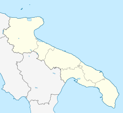
Cerignola (Italian pronunciation: [tʃeriɲˈɲɔːla]; Cerignolano: Ceregnòule [tʃərəɲˈɲɔwlə] ) is a town and comune of Apulia, Italy, in the province of Foggia, 40 kilometres (25 miles) southeast from the town of Foggia. It has the third-largest land area of any comune in Italy, at 593.71 square kilometres (229.23 sq mi), after Rome and Ravenna and it has the largest land area of any comune in Italy among those that are not the provincial capital. In 2017, it had a population of 58,534.[2]
© MMXXIII Rich X Search. We shall prevail. All rights reserved. Rich X Search


