Back جبل سيرو د پونتا ARZ Cerro de Punta Catalan Cerro de Punta (bukid sa Purtoriko) CEB Cerro de Punta Czech Cerro de Punta German Cerro de Punta Spanish Cerro de Punta French Cerro de Punta Italian Cerro de Punta LLD Cerro de Punta Polish
| Cerro de Punta | |
|---|---|
 Cerro de Punta as seen from Museo de Arte de Ponce, Ponce, Puerto Rico | |
| Highest point | |
| Elevation | 4,390 ft (1,340 m)[1] |
| Prominence | 4,389 ft (1,338 m) |
| Listing | |
| Coordinates | 18°10′21″N 66°35′31″W / 18.17250°N 66.59194°W[2] |
| Geography | |
| Location | Jayuya, Puerto Rico |
| Parent range | Cordillera Central |
| Climbing | |
| Easiest route | PR-143 |
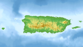
Cerro de Punta or Cerro Punta is the highest peak in Puerto Rico, rising to 1,338 meters (4,390 ft) above sea level.[note 1] The mountain is part of the Cordillera Central and is located in the municipality of Ponce.[3][4][5][1][6]
- ^ a b Cite error: The named reference
usgs_2005was invoked but never defined (see the help page). - ^ "Cerro de Punta". Geographic Names Information System. United States Geological Survey, United States Department of the Interior. Retrieved 25 January 2015.
- ^ Government of the Commonwealth of Puerto Rico. Office of Management and Budgeting. Government Information and Technology Area. Geographic Information Systems Unit. General Purpose Population Data, Census 2000. Archived 2010-08-12 at the Wayback Machine Retrieved March 21, 2010.
- ^ Ponce Topographic Map. Map Styles: Map and Shaded. Trails.com. From: United States Geological Survey. Topo Map. Projection: NAD83/WGS84. Retrieved February 22, 2010.
- ^ Puerto Rico Physical Features: Summits. PR Home Town Locator. United States Geological Survey. Retrieved 7 June 2011.
- ^ Science In Your Backyard: Puerto Rico: Puerto Rico State Facts. U.S. Geological Survey. Retrieved March 21, 2010. Archived.
Cite error: There are <ref group=note> tags on this page, but the references will not show without a {{reflist|group=note}} template (see the help page).
© MMXXIII Rich X Search. We shall prevail. All rights reserved. Rich X Search
