Back مقاطعة شيشاير (نيو هامبشاير) Arabic Cheshire County, New Hampshire BAR Чешър (окръг, Ню Хампшър) Bulgarian চেসায়ার কাউন্টি, নিউ হ্যাম্পশায়ার BPY Cheshire Gông (New Hampshire) CDO Чешир (гуо, Нью-Гэмпшир) CE Cheshire County CEB Cheshire County Czech Cheshire County, New Hampshire Welsh Cheshire County German
Cheshire County | |
|---|---|
 Cheshire County Courthouse in Keene | |
 Location within the U.S. state of New Hampshire | |
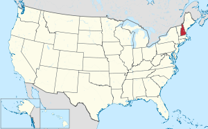
 New Hampshire's location within the U.S. | |
| Coordinates: 42°54′42″N 72°14′31″W / 42.9118°N 72.242081°W | |
| Country | |
| State | |
| Founded | 1769 |
| Named for | Cheshire |
| Seat | Keene |
| Largest city | Keene |
| Area | |
| • Total | 728.9 sq mi (1,888 km2) |
| • Land | 706.7 sq mi (1,830 km2) |
| • Water | 22.2 sq mi (57 km2) 3.1% |
| Population (2020) | |
| • Total | 76,458 |
| • Density | 108.2/sq mi (41.8/km2) |
| Time zone | UTC−5 (Eastern) |
| • Summer (DST) | UTC−4 (EDT) |
| Congressional district | 2nd |
| Website | co |
Cheshire County is a county in the southwestern corner of the U.S. state of New Hampshire. As of the 2020 census, the population was 76,458.[1] Its county seat is the city of Keene.[2] Cheshire was one of the five original counties of New Hampshire, and is named for the county of Cheshire in England. It was organized in 1771 at Keene. Sullivan County was created from the northern portion of Cheshire County in 1827.
Cheshire County comprises the Keene, NH micropolitan statistical area.
- ^ "Census - Geography Profile: Cheshire County, New Hampshire". United States Census Bureau. Retrieved November 21, 2021.
- ^ "Find a County". National Association of Counties. Archived from the original on May 3, 2015. Retrieved June 7, 2011.
© MMXXIII Rich X Search. We shall prevail. All rights reserved. Rich X Search
