Back Чоп Bashkir Чоп Byelorussian Чоп BE-X-OLD Чоп (Украйна) Bulgarian Chop CEB Çop CRH Čop Czech Чоп CV Tjop Danish Tschop German
Chop
Чоп Csap | |
|---|---|
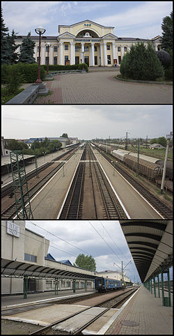
 Railway station in Chop | |
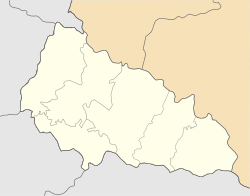
| Coordinates: 48°25′50″N 22°12′00″E / 48.43056°N 22.20000°E | |
| Country | |
| Oblast | Zakarpattia Oblast |
| Raion | Uzhhorod Raion |
| Hromada | Chop urban hromada |
| Government | |
| • Mayor | Galina Car |
| Elevation | 103 m (338 ft) |
| Population (2022) | |
| • Total | 8,626 |
| Time zone | UTC+1 (CET) |
| • Summer (DST) | UTC+2 (CEST) |
| Postal code | 89500 — 89509 |
| Area code | +380 22 |
| Climate | Cfb |
| Sister cities | Milove (Ukraine) Sokołów Małopolski, (Poland) Záhony (Hungary) |
| Website | chop-rada |
Chop (Ukrainian: Чоп, Hungarian: Csap, Slovak: Čop, Rusyn: Чоп, Yiddish: טשאָפּ) is a city located in Zakarpattia Oblast (province) of western Ukraine, near the borders of Slovakia and Hungary. It is separated from the Hungarian town of Záhony by the river Tisza by being situated on its right bank. It is located within Uzhhorod Raion. Today, the population is 8,626 (2022 estimate).[2]
- ^ "Chop (Zakarpattia Oblast, Uzhhorod Raion)". weather.in.ua (in Ukrainian). Retrieved 25 December 2018.
- ^ Чисельність наявного населення України на 1 січня 2022 [Number of Present Population of Ukraine, as of January 1, 2022] (PDF) (in Ukrainian and English). Kyiv: State Statistics Service of Ukraine. Archived (PDF) from the original on 4 July 2022.
© MMXXIII Rich X Search. We shall prevail. All rights reserved. Rich X Search


