Back Kaliron adası Azerbaijani Кларыён Byelorussian Isla Clarión CEB Clarión German Insulo Klarjono Esperanto Isla Clarión Spanish Clarión Finnish Île Clarion French Illa Clarión Galician Isola Clarión Italian
Native name: Isla Clarión | |
|---|---|
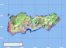
 Clarion Island, from Landsat satellite | |
 | |
| Geography | |
| Location | Pacific Ocean |
| Coordinates | 18°21′30″N 114°43′30″W / 18.35833°N 114.72500°W |
| Archipelago | Revillagigedo Islands |
| Total islands | 4 |
| Major islands | San Benedicto, Socorro, Roca Partida & Clarión |
| Area | 19.8 km2 (7.6 sq mi) |
| Length | 8.6 km (5.34 mi) |
| Width | 3.7 km (2.3 mi) |
| Highest elevation | 335 m (1099 ft) |
| Highest point | Mount (Monte) Gallegos |
| Administration | |
Mexico | |
| Demographics | |
| Population | 9 |
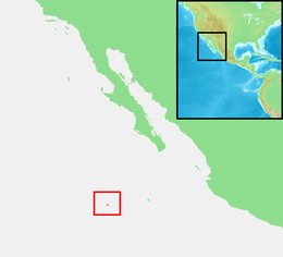
Clarion Island (Spanish: Isla Clarión), formerly Santa Rosa, is the second largest, westernmost and most remote of Mexico's Revillagigedo Islands. The island is located 314 kilometres (195 mi) west of Socorro Island and over 700 kilometres (430 mi) from the Mexican mainland.
It has an area of 19.80 square kilometres (7.64 sq mi)[1] and three prominent peaks. The westernmost and tallest peak, Monte Gallegos, is 335 metres (1,099 ft) high. The central peak is called Monte de la Marina, 280 metres (920 ft), and the eastern peak Pico de la Tienda 292 metres (958 ft). The coasts are backed by perpendicular cliffs, 24 to 183 metres (79 to 600 ft) high, with the exception of the middle part of the southern coast in the vicinity of Bahía Azufre (Sulphur Bay), which is the location of a small military garrison with a contingent of 9 soldiers[citation needed].
Two small and at least temporarily brackish pools are the only source of fresh water; even these may dry up in summers with little rain.[2] Clarion can only be reached by sea, which from Mexico takes 30 hours.
© MMXXIII Rich X Search. We shall prevail. All rights reserved. Rich X Search