Back Districte de Cloppenburg Catalan Landkreis Cloppenburg CEB Zemský okres Cloppenburg Czech Landkreis Cloppenburg Danish Landkreis Cloppenburg German Distrikto Cloppenburg Esperanto Distrito de Cloppenburg Spanish Cloppenburgi kreis Estonian کلوپنبورگ (ناحیه) Persian Arrondissement de Cloppenburg French
Cloppenburg | |
|---|---|
 | |
| Country | Germany |
| State | Lower Saxony |
| Capital | Cloppenburg |
| Government | |
| • District admin. | Johann Wimberg (CDU) |
| Area | |
| • Total | 1,418 km2 (547 sq mi) |
| Population (31 December 2022)[1] | |
| • Total | 177,701 |
| • Density | 130/km2 (320/sq mi) |
| Time zone | UTC+01:00 (CET) |
| • Summer (DST) | UTC+02:00 (CEST) |
| Vehicle registration | CLP |
| Website | lkclp.de |
Cloppenburg is a district in Lower Saxony, Germany. It is bounded by (from the north and clockwise) the districts of Ammerland, Oldenburg, Vechta, Osnabrück, Emsland and Leer.


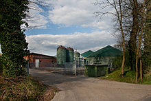
Like the neighbouring Vechta district, it is well known for factory farming, especially of turkeys and pigs. These two districts are also known as the Schweinegürtel (“pig belt”). The ground is mostly of poor quality. The mass import of animal food made factory farming possible. With the help of liquid manure, corn is grown, which is also used for a growing production of biogas.[2]
- ^ "LSN-Online Regionaldatenbank, Tabelle A100001G: Fortschreibung des Bevölkerungsstandes, Stand 31. Dezember 2022" (in German). Landesamt für Statistik Niedersachsen.
- ^ Wilking, Johannes und Manfred Kayser: Biogaserzeugung im Oldenburger Münsterland - Entwicklungen und Perspektiven. In: Jahrbuch für das Oldenburger Münsterland 2011. Vechta 2010, S. 196-219
© MMXXIII Rich X Search. We shall prevail. All rights reserved. Rich X Search

