Back Mageoscīr ANG مقاطعة مايو Arabic كاونتى مايو ARZ Condáu de Mayo AST County Mayo BAN Мейо (графство) Bulgarian Kontelezh Maigh Eo Breton Comtat de Mayo Catalan Maigh Eo CEB Hrabství Mayo Czech
County Mayo
Contae Mhaigh Eo (Irish) | |
|---|---|
| Nicknames: The Maritime County, The Yew County (Others) | |
| Motto(s): | |
 | |
| Country | Ireland |
| Province | Connacht |
| Region | Northern and Western |
| Established | c. 1570[1] |
| County town | |
| Government | |
| • Local authority | Mayo County Council |
| • Dáil constituencies | |
| • EP constituency | Midlands–North-West |
| Area | |
• Total | 5,588 km2 (2,158 sq mi) |
| • Rank | 3rd |
| Population | |
• Total | 137,231 |
| • Rank | 18th |
| • Density | 25/km2 (64/sq mi) |
| Time zone | UTC±0 (WET) |
| • Summer (DST) | UTC+1 (IST) |
| Eircode routing keys | F12, F23, F26, F28, F31, F35 (primarily) |
| Telephone area codes | 093–098 (primarily) |
| ISO 3166 code | IE-MO |
| Vehicle index mark code | MO |
| Website | Official website |
 | |
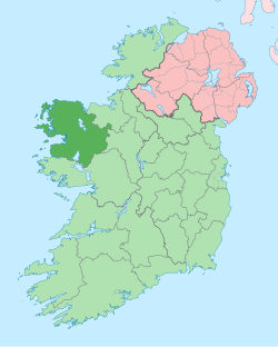
County Mayo (/ˈmeɪoʊ/;[4] from Irish Maigh Eo, Contae Mhaigh Eo, meaning 'Plain of the yew trees') is a county in Ireland. In the West of Ireland, in the province of Connacht, it is named after the village of Mayo, now generally known as Mayo Abbey. Mayo County Council is the local authority. The population was 137,231 at the 2022 census.[3] The boundaries of the county, which was formed in 1585, reflect the Mac William Íochtar lordship at that time.
- ^ "A short history County Mayo in the West of Ireland - mayo-ireland.ie". www.mayo-ireland.ie. Archived from the original on 19 June 2019. Retrieved 19 June 2019.
- ^ "County Profiles – Mayo". Western Development Commission. Archived from the original on 2 June 2021. Retrieved 2 June 2021.
- ^ a b "Census of Population 2022 - Preliminary Results". Central Statistics Office (Ireland). 23 June 2022. Retrieved 22 May 2023.
- ^ "Mayo". Lexico.com. Archived from the original on 6 December 2021. Retrieved 6 December 2021.
© MMXXIII Rich X Search. We shall prevail. All rights reserved. Rich X Search
