Back نهر كورانتين ARZ Карантэйн Byelorussian Корантейн Bulgarian Corantijn Breton Courantyne River (suba sa Guyane) CEB Courantyne Czech Corantijn German Korantino (rivero) Esperanto Río Courantyne Spanish Corentyne French
| Courantyne River Corentyne, Corantijn River | |
|---|---|
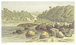
 Wonotobo Middle Fall in the Corentyne Basin from Canoe and Camp Life in British Guiana by Charles Barrington Brown | |
| Location | |
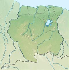
| Country | Suriname, Guyana |
| Physical characteristics | |
| Mouth | Atlantic Ocean |
• coordinates | 5°57′N 57°06′W / 5.950°N 57.100°W |
| Length | 724 km (450 mi) |
| Basin size | 69,000 km2 (27,000 sq mi) |
| Discharge | |
| • location | mouth |
| • average | 2,300 m3/s (81,000 cu ft/s) |
The Courantyne River (/ˈkɜːrənˌtaɪn/;[1] also Corentyne, Corantijn [ˌkoːrɑnˈtɛi̯n] ) is a river in northern South America in Suriname and Guyana. It is the longest river in the country and creates the border between Suriname and the East Berbice-Corentyne region of Guyana.
Its tributaries include Kutari River, Coeroeni River, New River, and Zombie Creek.[2] In Suriname; Kabalebo River, Lucie River, Sipaliwini River, Kutari River.
- ^ "Definition of 'Courantyne'".
- ^ "Zombie Creek, Guyana - Geographical Names, map, geographic coordinates". geographic.org. Retrieved 2021-01-21.
© MMXXIII Rich X Search. We shall prevail. All rights reserved. Rich X Search
