Back Currie (lungsod sa Hiniusang Gingharian) CEB Currie (Schottland) German Currie Basque Currie (Écosse) French Currach Irish Currie, Skottland Swedish
Currie
| |
|---|---|
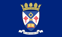
 The Flag of Currie | |
 The Coat of Arms of Currie | |
Location within the City of Edinburgh council area Location within Scotland | |
| Population | 7,494 (2011) |
| OS grid reference | NT182677 |
| Council area | |
| Country | Scotland |
| Sovereign state | United Kingdom |
| Post town | CURRIE |
| Postcode district | EH14 |
| Dialling code | 0131 |
| Police | Scotland |
| Fire | Scottish |
| Ambulance | Scottish |
| UK Parliament | |
| Scottish Parliament | |
Currie (Scottish Gaelic: Currach, IPA:[ˈkʰuːᵲəx]) is a village and suburb on the outskirts of Edinburgh, Scotland, situated 7 miles (11 kilometres) south west of the city centre. Formerly within the County of Midlothian, it now falls within the jurisdiction of the City of Edinburgh Council. It is situated between Juniper Green to the northeast and Balerno to the southwest. It gives its name to a civil parish.
In 2001, the population of Currie was 8,550 and it contained 3,454 houses.[1]
- ^ "Currie Community Council". Archived from the original on 25 June 2010. Retrieved 24 June 2012.
© MMXXIII Rich X Search. We shall prevail. All rights reserved. Rich X Search

