Back دبورية Arabic Dabbūrīya CEB Daburija Czech دبوریه Persian Daburiyya Finnish דבורייה HE Daburiyya NN Dabburijja Polish Дабурия Russian Dabbūrīya Swedish
Daburiyya
| |
|---|---|
Local council (from 1961) | |
| Hebrew transcription(s) | |
| • ISO 259 | Dabburiya |
| • Also spelled | Deburieh (unofficial) |
 | |
| Coordinates: 32°41′31″N 35°22′18″E / 32.69194°N 35.37167°E | |
| Grid position | 185/232 PAL |
| Country | |
| District | Northern |
| Area | |
• Total | 7,200 dunams (7.2 km2 or 2.8 sq mi) |
| Population (2022)[1] | |
• Total | 10,831 |
| • Density | 1,500/km2 (3,900/sq mi) |

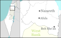
Daburiyya (Arabic: دبورية; Hebrew: דַבּוּרִיָּה),[2] also Deburieh or Dabburieh, is an Arab local council around 8 kilometres (5.0 mi) east of Nazareth in Israel's Northern District. Daburriya gained local council status in 1961. Its jurisdiction extends over 7,200 dunams. In 2022 it had a population of 10,831.[1]
Daburiyya is located off of Highway 65 at the foot of Mount Tabor in the Lower Galilee, near the area where the prophetess Deborah judged.
- ^ a b "Regional Statistics". Israel Central Bureau of Statistics. Retrieved 21 March 2024.
- ^ Palmer, 1881, p. 125
© MMXXIII Rich X Search. We shall prevail. All rights reserved. Rich X Search

