Back Дагъистаналъул вилаят AV Dağıstan vilayəti Azerbaijani Дагестанская вобласць Byelorussian ئۆبلاستی داغستان CKB Oblast Dagestan German Óblast de Daguestán Spanish استان داغستان Persian Oblast du Daghestan French Oblast' del Daghestan Italian დაღესტნის ოლქი Georgian
Dagestan Oblast
Дагестанская область | |
|---|---|
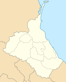
 Administrative map of the Dagestan Oblast | |
| Country | Russian Empire |
| Viceroyalty | Caucasus |
| Established | 1860 |
| Abolished | 1921 |
| Capital | Temir-Khan-Shura (present-day Buynaksk) |
| Area | |
| • Total | 29,709.63 km2 (11,470.95 sq mi) |
| Highest elevation | 4,466 m (14,652 ft) |
| Population (1916) | |
| • Total | 713,342 |
| • Density | 24/km2 (62/sq mi) |
| • Urban | 9.81% |
| • Rural | 90.19% |
The Dagestan Oblast[a] was a province (oblast) of the Caucasus Viceroyalty of the Russian Empire. It roughly corresponded to most of present-day southeastern Dagestan within the Russian Federation. The Dagestan oblast was created in 1860 out of the territories of the former Caucasian Imamate, bordering the Terek Oblast to the north, the Tiflis Governorate and Zakatal Okrug to the west, the Elizavetpol Governorate to the south, and Baku Governorate to the east. The administrative center of the oblast was Temir-Khan-Shura (present-day Buynaksk).[1]
Cite error: There are <ref group=lower-alpha> tags or {{efn}} templates on this page, but the references will not show without a {{reflist|group=lower-alpha}} template or {{notelist}} template (see the help page).
© MMXXIII Rich X Search. We shall prevail. All rights reserved. Rich X Search
