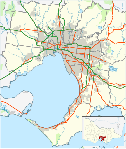
| Dandenong Valley Parklands | |
|---|---|
 The lake in the centre of Jells Park | |
| Type | Metropolitan parks |
| Location | South east suburbs of Melbourne, Victoria, Australia |
| Coordinates | 37°53′48″S 145°11′47″E / 37.896711°S 145.196394°E |
| Area | 1,306 hectares |
| Elevation | 100 m |
| Opened | 1976 |
| Managed by | Primarily Parks Victoria (also Melbourne Water, City of Monash, City of Knox, City of Whitehorse) |
| Visitors | 1.5 million (in 2006) |
| Status | Open all year |
| Paths | Dandenong Creek Trail, Scotchmans Creek Trail, EastLink Trail |
| Vegetation | Swampy woodland, swampy riparian woodland, valley heathy forest |
| Website | Parks Victoria |
The Dandenong Valley Parklands are a collection of public parks and open space reserves along the Dandenong Creek, an urban creek in southeastern Melbourne, Victoria, Australia.[1][2] The term refers only to the parklands along and in close proximity to the middle main stem of Dandenong Creek, stretching from Boronia Road in the north to Wellington Road in the south[3] through the suburbs of Vermont South, Wantirna, Wantirna South and Wheelers Hill,[4] even though there are a lot more parks and reserves along the extended catchment of the creek.
The parklands are separated into six individual parks, roughly following the middle Dandenong Creek north-south for about 10 km (6.2 mi).[5] These include a range of landscapes including remnant bushland, grassland, artificial lakes, retarding basinss, wetlands, and open parkland. The parklands form a large part of the habitat corridor of Dandenong Creek, along with some nearby public spaces such as the Police Road Retarding Basin/Tirhatuan Park, Dandenong Police Paddocks Reserve, Dandenong Wetlands (Melbourne Water Recreation Area) and Churchill National Park.[5]: 1
- ^ "Dandenong Valley Parklands" (PDF). Park Notes. Parks Victoria. September 2014. Archived from the original (PDF) on 21 July 2019. Retrieved 24 July 2019.
- ^ Lorimer, Graeme S. (28 June 2010). "Site 58. Dandenong Valley Parklands" (PDF). Sites of Biological Significance in Knox. Vol. II (2nd ed.). Knox City Council.
- ^ Dandenong Valley Parklands (PDF) (Map). Parks Victoria. August 2013. Archived from the original (PDF) on 5 September 2015. Retrieved 25 July 2019.
- ^ Melway (Street map) (44 ed.). Ausway Publishing Pty Ltd. 2018. § Maps 62, 63, 71, 72, 81. Retrieved 25 July 2019.
- ^ a b Parks Victoria (June 2006). Dandenong Valley Parklands Future Directions Plan (PDF). State Government of Victoria. ISBN 0-7311-8357-6. Archived from the original (PDF) on 3 July 2013. Retrieved 25 July 2019.
© MMXXIII Rich X Search. We shall prevail. All rights reserved. Rich X Search

