Back مقاطعة ديكالب Arabic دکالب بؤلگهسی، جورجیا AZB DeKalb County, Georgia BAR Дикалб (окръг, Джорджия) Bulgarian ডেকলাব কাউন্টি, জর্জিয়া BPY DeKalb Gông (Georgia) CDO ДеКалб (гуо, Джорджи) CE DeKalb County (kondado sa Tinipong Bansa, Georgia) CEB DeKalb County (Georgie) Czech DeKalb County, Georgia Welsh
DeKalb County | |
|---|---|
 | |
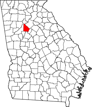
 Location within the U.S. state of Georgia | |
 Georgia's location within the U.S. | |
| Coordinates: 33°46′N 84°14′W / 33.77°N 84.23°W | |
| Country | |
| State | |
| Founded | December 9, 1822 |
| Named for | Johann de Kalb |
| Seat | Decatur |
| Largest city | Atlanta |
| Area | |
| • Total | 271 sq mi (700 km2) |
| • Land | 268 sq mi (690 km2) |
| • Water | 3.6 sq mi (9 km2) 1.3% |
| Population (2020) | |
| • Total | 764,382 |
| • Estimate (2023) | 762,992 |
| • Density | 2,800/sq mi (1,100/km2) |
| Time zone | UTC−5 (Eastern) |
| • Summer (DST) | UTC−4 (EDT) |
| Congressional districts | 4th, 5th |
| Website | dekalbcountyga.gov |
DeKalb County (/dəˈkæb/, /ˌdiːˈkæb/ də-KAB, DEE-KAB) is located in the north central portion of the U.S. state of Georgia. As of the 2020 census, the population was 764,382,[1] making it Georgia's fourth-most populous county. Its county seat is Decatur.[2]
DeKalb County is included in the Atlanta–Sandy Springs–Roswell metropolitan area. It contains roughly 10% of the city of Atlanta (the other 90% lies in Fulton County).[3] Stonecrest is the largest city that is entirely within the county. DeKalb is primarily a suburban county.
In recent years, some communities in North DeKalb have incorporated, following a trend in other suburban areas around Metro Atlanta. Stonecrest, Dunwoody and Brookhaven are now the largest cities that are entirely contained within the county.
- ^ "State & County QuickFacts". United States Census Bureau. Retrieved August 12, 2021.
- ^ "Find a County". National Association of Counties. Archived from the original on May 31, 2011. Retrieved June 7, 2011.
- ^ "Atlanta City Limits". City of Atlanta - Department of City Planning. Retrieved April 18, 2022.
© MMXXIII Rich X Search. We shall prevail. All rights reserved. Rich X Search


