Back مقاطعة ديفيانس (أوهايو) Arabic دفیانس بؤلگهسی، اوهایو AZB Defiance County, Ohio BAR Дифайънс (окръг, Охайо) Bulgarian ডেফিয়ান্সে কাউন্টি, ওহাইও BPY Defiance Gông (Ohio) CDO Defiance County CEB Defiance County, Ohio Welsh Defiance County Danish Defiance County German
Defiance County | |
|---|---|
 | |
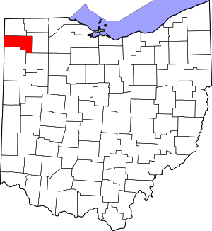
 Location within the U.S. state of Ohio | |
 Ohio's location within the U.S. | |
| Coordinates: 41°19′N 84°29′W / 41.32°N 84.49°W | |
| Country | |
| State | |
| Founded | April 7, 1845[1] |
| Named for | Fort Defiance |
| Seat | Defiance |
| Largest city | Defiance |
| Area | |
| • Total | 414 sq mi (1,070 km2) |
| • Land | 411 sq mi (1,060 km2) |
| • Water | 2.7 sq mi (7 km2) 0.7% |
| Population (2020) | |
| • Total | 38,286 |
| • Density | 92/sq mi (36/km2) |
| Time zone | UTC−5 (Eastern) |
| • Summer (DST) | UTC−4 (EDT) |
| Congressional district | 9th |
| Website | www |
Defiance County is a county located in the U.S. state of Ohio. As of the 2020 census, the population was 38,286.[2] Its county seat and largest city is Defiance.[3] The county was named after an early Army fortification, Fort Defiance, which was so named by Mad Anthony Wayne to signify the settlers' "defiance" of the Indians.[4][5] The Defiance, OH Micropolitan Statistical Area includes all of Defiance County.
- ^ "Ohio County Profiles: Defiance County" (PDF). Ohio Department of Development. Archived from the original (PDF) on June 21, 2007. Retrieved April 28, 2007.
- ^ 2020 census
- ^ "Find a County". National Association of Counties. Archived from the original on May 31, 2011. Retrieved June 7, 2011.
- ^ "Maumee Valley Heritage Corridor". Archived from the original on June 28, 2007. Retrieved April 5, 2007.
- ^ Gannett, Henry (1905). The Origin of Certain Place Names in the United States. Govt. Print. Off. p. 102.
© MMXXIII Rich X Search. We shall prevail. All rights reserved. Rich X Search

