Back دير الدبان Arabic دير الدبان ARZ Deir al-Dubban French דיר דבאן HE Deir al-Dubban ID Dajr ad-Dubban Polish دیر الدبان Urdu
Deir al-Dubban
دير الدبان Dayr ad-Dhubban | |
|---|---|
| Etymology: "Monastery of the Flies"[1] | |
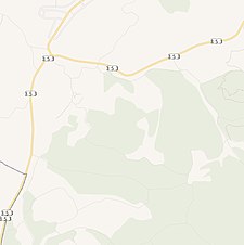
A series of historical maps of the area around Deir al-Dubban (click the buttons) | |
Location within Mandatory Palestine | |
| Coordinates: 31°40′23″N 34°53′33″E / 31.67306°N 34.89250°E | |
| Palestine grid | 139/120 |
| Geopolitical entity | Mandatory Palestine |
| Subdistrict | Hebron |
| Date of depopulation | October 23–24, 1948[4] |
| Area | |
| • Total | 7,784 dunams (7.784 km2 or 3.005 sq mi) |
| Population (1945) | |
| • Total | 730[2][3] |
| Cause(s) of depopulation | Military assault by Yishuv forces |
| Current Localities | Luzit, Britannia Park[5] |
Deir al-Dubban (Arabic: دير الدبان, from Dayr ad-Dhubban, literally, the "Monastery of the Flies"[1]) was a small Palestinian village 26 kilometers (16 mi) northwest of Hebron, near the modern village of Luzit, between Jerusalem, and Ashkelon.[6] The village was ethnically cleansed in the 1948 Palestine War.
- ^ a b Palmer, 1881, p. 267
- ^ Department of Statistics, 1945, p. 23
- ^ a b Government of Palestine, Department of Statistics. Village Statistics, April, 1945. Quoted in Hadawi, 1970, p. 50 Archived 2011-06-04 at the Wayback Machine
- ^ Morris, 2004, p. xix, village #293, Also gives cause of depopulation.
- ^ Dear Prince William, if you have to go, make it count, Robert Cohen, March 10, 2018, Mondoweiss
- ^ Sharon, 2004, pp. 20-36
© MMXXIII Rich X Search. We shall prevail. All rights reserved. Rich X Search


