Back Дэмерара Byelorussian Demerara River CEB Demerara Czech Демерара CV Demerara River German Río Demerara Spanish Demerara (fleuve) French Demerara (rivier) Frisian Демерара Kazakh Demerarius (flumen) Latin
| Demerara River | |
|---|---|
 Crossing the Demerara River via the Demerara Harbour Bridge | |
| Location | |
| Country | Guyana |
| Physical characteristics | |
| Mouth | Atlantic Ocean |
• location | Georgetown |
• coordinates | 6°48′44″N 58°10′12″W / 6.8121°N 58.1701°W |
| Length | 346 km (215 mi) |
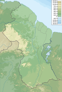
The Demerara River is a river in eastern Guyana that rises in the central rainforests of the country and flows to the north for 346 kilometres until it reaches the Atlantic Ocean. Georgetown, Guyana's largest seaport and capital, is situated on the east bank of the river's mouth. The river divides Essequibo Islands-West Demerara (Region 3) on the west bank from Demerara-Mahaica (Region 4) to the east.
The name "Demerara" comes from a variant of the Arawak word "Immenary" or "Dumaruni" which means "river of the letter wood" (wood of Brosimum guianense tree).[1]
- ^ Benn, Brindley H. (1962-06-30). "Guyana the Name". Thunder. Georgetown, Guyana. Archived from the original on May 1, 2008.
© MMXXIII Rich X Search. We shall prevail. All rights reserved. Rich X Search
