Back دنبيشير Arabic Дэнбішыр Byelorussian Денбишър Bulgarian Sir Ddinbych Breton Sir Ddinbych Catalan Denbighshire CEB Denbighshire Czech Sir Ddinbych Welsh Denbighshire Danish Denbighshire German
This article's lead section contains information that is not included elsewhere in the article. (October 2023) |
Denbighshire
Sir Ddinbych (Welsh) | |
|---|---|
| |
 Denbighshire shown within Wales | |
| Sovereign state | |
| Constituent country | |
| Preserved county | Clwyd |
| Established | 1 April 1996 |
| Administrative HQ | Ruthin |
| Largest town | Rhyl |
| Government | |
| • Type | Principal council |
| • Body | Denbighshire County Council |
| • Executive | TBA (council NOC) |
| • Leader | Jason McLellan (Welsh Labour) |
| • Chairman | Arwel Roberts |
| • Chief Executive | Graham Boase |
| • MPs | James Davies (C) David Jones (C) Simon Baynes (C) |
| Area | |
| • Total | 326 sq mi (844 km2) |
| • Rank | 8th |
| Population (2022) | |
| • Total | 96,558 |
| • Rank | 16th |
| • Density | 300/sq mi (115/km2) |
| Time zone | UTC+0 (Greenwich Mean Time) |
| • Summer (DST) | UTC+1 (British Summer Time) |
| GSS code | W06000004 |
| ISO 3166-2 | GB-DEN |
| NUTS 3 code | UKL13 |
| ONS code | 00NG |
| Website | www.denbighshire.gov.uk |

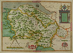
Denbighshire (/ˈdɛnbiʃər, -ʃɪər/ DEN-bee-shər, -sheer;[1] Welsh: Sir Ddinbych [ˌsiːr ˈðɪnbɨχ]) is a county in the north-east of Wales. It borders the Irish Sea to the north, Flintshire to the east, Wrexham to the southeast, Powys to the south, and Gwynedd and Conwy to the west. Rhyl is the largest town, and Ruthin is the administrative centre. Its borders differ from the historic county of the same name.
Denbighshire has an area of 326 square miles (840 km2) and a population of 95,800, making it sparsely populated. The most populous area is the coast, where Rhyl and Prestatyn form a single built-up area with a population of 46,267. The next-largest towns are Denbigh, Ruthin, and Rhuddlan, while St Asaph is its only city. All of these settlements are in the northern half of the county; the south is even less densely populated, and the only towns are Corwen and Llangollen.
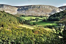
The geography of Denbighshire is defined by the broad valley of the River Clwyd, which is surrounded by rolling hills on all sides except the north, where it reaches the coast. The Vale of Clwyd, the lower valley, is given over to crops, while cattle and sheep graze the uplands. The Clwydian Range in the east is part of the Clwydian Range and Dee Valley Area of Outstanding Natural Beauty.

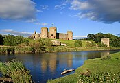
This part of Wales contains the country's oldest known evidence of habitation – Pontnewydd (Bontnewydd-Llanelwy) Palaeolithic site has Neanderthal remains of some 225,000 years ago. The county is also home to several medieval castles, including Castell Dinas Brân, Denbigh, and Rhuddlan, as well as St Asaph Cathedral. Llangollen International Musical Eisteddfod takes place in the town each July.[2]
- ^ Jones, Daniel (2011). Roach, Peter; Setter, Jane; Esling, John (eds.). Cambridge English Pronouncing Dictionary (18th ed.). Cambridge University Press. ISBN 978-0-521-15255-6.
- ^ "Attractions in Clwyd". Britain Express. Retrieved 21 April 2016.
© MMXXIII Rich X Search. We shall prevail. All rights reserved. Rich X Search


