Back Door Peninsula CEB Door-Halbinsel German Péninsule de Door French חצי האי דור HE ドア半島 Japanese Península de Door Portuguese 多尔半岛 Chinese

| Designations | |
|---|---|
| Official name | Door Peninsula Coastal Wetlands |
| Criteria | Door County § Wetlands |
| Designated | 10 June 2014 |
| Reference no. | 2218[1] |
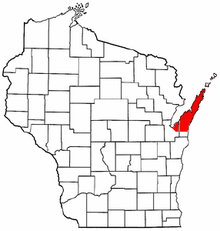
The Door Peninsula is a peninsula in eastern Wisconsin, separating the southern part of the Green Bay from Lake Michigan. The peninsula includes northern Kewaunee County, northeastern Brown County, and the mainland portion of Door County. It is on the western side of the Niagara Escarpment. Well known for its cherry and apple orchards, the Door Peninsula is a popular tourism destination. With the 1881 completion of the Sturgeon Bay Ship Canal, the northern half of the peninsula became an island.[2]
Limestone outcroppings of the Niagara Escarpment are visible on both shores of the peninsula, but are larger and more prominent on the Green Bay side as seen at the Bayshore Blufflands. Progressions of dunes have created much of the rest of the shoreline, especially on the east side. Flora along the shore demonstrate plant succession during periods of low lake levels. The middle of the peninsula is mostly flat. Beyond the peninsula's northern tip is a series of islands, the largest of which is Washington Island. The partially submerged ridge extends farther north, becoming the Garden Peninsula in Michigan's Upper Peninsula.[3]
- ^ "Door Peninsula Coastal Wetlands". Ramsar Sites Information Service. Retrieved April 25, 2018.
- ^ Seeing The Light – Sturgeon Bay Ship Canal Pierhead Light
- ^ The Niagara Escarpment Archived 2008-05-02 at the Wayback Machine
© MMXXIII Rich X Search. We shall prevail. All rights reserved. Rich X Search