Back مقاطعة دوغلاس (كولورادو) Arabic Douglas County, Colorado BAR Дуглас (акруга, Каларада) Byelorussian Дъглас (окръг, Колорадо) Bulgarian ডগলাস কাউন্টি, কলোরাডো BPY Douglas Gông (Colorado) CDO Дуглас (гуо, Колорадо) CE Douglas County (kondado sa Tinipong Bansa, Colorado) CEB Douglas County (Colorado) Czech Douglas County, Colorado Welsh
Douglas County | |
|---|---|
 One of two county buildings for Douglas County in Castle Rock | |
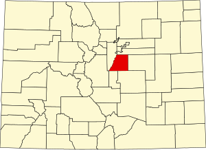
 Location within the U.S. state of Colorado | |
 Colorado's location within the U.S. | |
| Coordinates: 39°21′N 104°56′W / 39.35°N 104.93°W | |
| Country | |
| State | |
| Founded | November 1, 1861 |
| Named for | Stephen A. Douglas |
| Seat | Castle Rock |
| Largest community | Highlands Ranch |
| Area | |
| • Total | 843 sq mi (2,180 km2) |
| • Land | 840 sq mi (2,200 km2) |
| • Water | 2.6 sq mi (7 km2) 0.3% |
| Population (2020) | |
| • Total | 357,978 |
| • Density | 426/sq mi (164/km2) |
| Time zone | UTC−7 (Mountain) |
| • Summer (DST) | UTC−6 (MDT) |
| Congressional districts | 4th, 6th |
| Website | www |


Douglas County is a county located in the U.S. state of Colorado. As of the 2020 Census, the population was 357,978. The county is named in honor of U.S. Senator Stephen A. Douglas.[1] The county seat is Castle Rock.[2]
Douglas County is part of the Denver–Aurora–Lakewood metropolitan statistical area. It is located midway between Colorado's two largest cities, Denver and Colorado Springs, and contains a portion of Aurora, the state's third-largest city. Douglas County has the highest median household income of any Colorado county or statistical equivalent. It is ranked seventh nationally in that category.
- ^ "State & County QuickFacts". United States Census Bureau. Retrieved September 5, 2021.
- ^ "Find a County". National Association of Counties. Archived from the original on May 31, 2011. Retrieved June 7, 2011.
© MMXXIII Rich X Search. We shall prevail. All rights reserved. Rich X Search
