Back Duffield (lungsod) CEB Duffield, Swydd Derby Welsh Duffield (Derbyshire) Spanish Duffield (Derbyshire) Basque Duffield (Derbyshire) French Duffield (Derbyshire) Italian Duffield LLD Duffield (Derbyshire) Dutch Duffield Polish Duffield Swedish
| Duffield | |
|---|---|
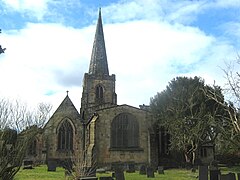
 St Alkmunds Church | |
Location within Derbyshire | |
| Area | 7.859 km2 (3.034 sq mi) |
| Population | 5,046 (2011 census)[1] |
| • Density | 642/km2 (1,660/sq mi) |
| OS grid reference | SK351476 |
| Civil parish |
|
| District | |
| Shire county | |
| Region | |
| Country | England |
| Sovereign state | United Kingdom |
| Post town | BELPER |
| Postcode district | DE56 |
| Dialling code | 01332 |
| Police | Derbyshire |
| Fire | Derbyshire |
| Ambulance | East Midlands |
| UK Parliament | |
Duffield (/ˈdʌfiːld/) is a village in the Amber Valley district of Derbyshire, 5 miles (8.0 km) north of Derby. It is centred on the western bank of the River Derwent at the mouth of the River Ecclesbourne. It is within the Derwent Valley Mills World Heritage Area and the southern foothills of the Pennines.
- ^ "Key Statistics: Dwellings; Quick Statistics: Population Density; Physical Environment: Land Use Survey 2005". Archived from the original on 11 February 2003. Retrieved 17 February 2015.
© MMXXIII Rich X Search. We shall prevail. All rights reserved. Rich X Search
