Back مقاطعة إيغل (كولورادو) Arabic Eagle County, Colorado BAR Ігл (акруга) Byelorussian Игъл (окръг) Bulgarian ঈগল কাউন্টি, কলোরাডো BPY Eagle Gông (Colorado) CDO Eagle County CEB Eagle County Czech Eagle County, Colorado Welsh Eagle County German
Eagle County | |
|---|---|
 The Eagle County Justice Center (county courthouse) in Eagle | |
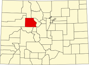
 Location within the U.S. state of Colorado | |
 Colorado's location within the U.S. | |
| Coordinates: 39°37′N 106°42′W / 39.62°N 106.7°W | |
| Country | |
| State | |
| Founded | February 11, 1883 |
| Named for | Eagle River |
| Seat | Eagle |
| Largest community | Edwards |
| Area | |
| • Total | 1,692 sq mi (4,380 km2) |
| • Land | 1,685 sq mi (4,360 km2) |
| • Water | 7.3 sq mi (19 km2) 0.4% |
| Population (2020) | |
| • Total | 55,731 |
| • Density | 33/sq mi (13/km2) |
| Time zone | UTC−7 (Mountain) |
| • Summer (DST) | UTC−6 (MDT) |
| Congressional districts | 2nd, 3rd |
| Website | www |
Eagle County is a county located in the U.S. state of Colorado. As of the 2020 census, the population was 55,731.[1] The county seat is the Town of Eagle and the most populous community is Edwards.[2] The county is named for the Eagle River.
Eagle County comprises the Edwards, Colorado, Micropolitan Statistical Area.
- ^ "State & County QuickFacts". United States Census Bureau. Retrieved September 5, 2021.
- ^ "Find a County". National Association of Counties. Archived from the original on July 12, 2012. Retrieved June 7, 2011.
© MMXXIII Rich X Search. We shall prevail. All rights reserved. Rich X Search
