Back جبل ياجل ARZ Eagle Mountain (Minnesota) BAR Eagle Mountain (bukid sa Tinipong Bansa, Minnesota, Cook County, lat 47,90, long -90,56) CEB Eagle Mountain (Minnesota) German Eagle Mountain (Minnesota) Dutch Eagle Mountain (Minnesota) Polish ٹلہ ایگل PNB Eagle Mountain (Minnesota) SIMPLE 鹰山 (明尼苏达州) Chinese
| Eagle Mountain | |
|---|---|
 The 2,301-foot Eagle Mountain, seen across Whale Lake. July 2014. | |
| Highest point | |
| Elevation | 2,301 ft (701 m) NGVD 29[1] |
| Prominence | 1,321 ft (403 m)[1] |
| Listing | U.S. state high point 37th |
| Coordinates | 47°53′51″N 90°33′36″W / 47.8973909°N 90.5601105°W[2] |
| Geography | |
| Parent range | Misquah Hills |
| Topo map | USGS Eagle Mountain |
| Climbing | |
| Easiest route | Maintained hiking trail |
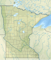
Eagle Mountain is the highest natural point in Minnesota, United States, at 2,301 feet (701 m). It is in northern Cook County in the Boundary Waters Canoe Area Wilderness and Superior National Forest in the Misquah Hills, northwest of Grand Marais. It is a Minnesota State Historic Site.[3]
Eagle Mountain is only about 15 miles (24 km) from Minnesota's lowest elevation, Lake Superior, at 600 feet (183 m).[4] It is part of the Canadian Shield. There is also another much shorter peak also named Eagle Mountain in northern Minnesota. The shorter peak is part of the Lutsen Mountains ski resort.
- ^ a b "Eagle Mountain, Minnesota". Peakbagger.com. Retrieved 2011-05-14.
- ^ "Eagle Mountain". Geographic Names Information System. United States Geological Survey, United States Department of the Interior. Retrieved 2011-05-14.
- ^ "Minnesota Statute § 138.57, subd. 3". Minnesota Revisor of Statutes. Retrieved 2007-02-26.
- ^ "Great Lakes Atlas: Factsheet #1". United States Environmental Protection Agency. April 11, 2011. Retrieved 2013-06-06.
© MMXXIII Rich X Search. We shall prevail. All rights reserved. Rich X Search
