Back Oos-Yorkshire Afrikaans إيست رايدينج أوف يوركشير Arabic Yorkshire del Este AST Yorkshire Kangin BAN Усходні райдынг Ёркшыру BE-X-OLD Източен Йоркшър Bulgarian ইস্ট রাইডিং অব ইয়র্কশায়ার Bengali/Bangla East Riding of Yorkshire Breton East Riding de Yorkshire Catalan East Riding of Yorkshire CEB
East Riding of Yorkshire | |
|---|---|
| Sovereign state | United Kingdom |
| Constituent country | England |
| Region | Yorkshire and the Humber |
| Established | 1 April 1996 |
| Established by | Local Government Commission for England |
| Preceded by | Humberside (1974–1996) |
| Origin | Geographic county/ administrative county (1889–1974) • Historic riding (AD 889 – 1 April 1889) |
| Time zone | UTC+0 (GMT) |
| • Summer (DST) | UTC+1 (BST) |
| Members of Parliament | 7 |
| Largest city | Hull |
| Ceremonial county | |
| Lord Lieutenant | James Dick[1] |
| High Sheriff | Miss Christina Cerutti[2] (2023–24) |
| Area | 2,479 km2 (957 sq mi) |
| • Ranked | 23rd of 48 |
| Population (2022) | 615,161 |
| • Ranked | 37th of 48 |
| Density | 248/km2 (640/sq mi) |
| Unitary authorities | |
| Councils | |
| Unitary authority | |
| Council | East Riding of Yorkshire Council |
| Executive | Conservative (council NOC) |
| Admin HQ | Beverley |
| Area | 2,404 km2 (928 sq mi) |
| • Ranked | 10th of 296 |
| Population | 346,309 |
| • Ranked | 28th of 296 |
| Density | 144/km2 (370/sq mi) |
| ISO 3166-2 | GB-ERY |
| ONS code | 00FB |
| GSS code | E06000011 |
| ITL | UKE11/12 |
| Website | eastriding |
| Districts | |
 Districts of East Riding of Yorkshire Unitary | |
| Districts | |
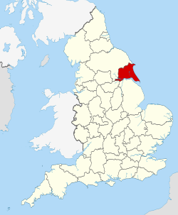
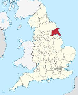
The East Riding of Yorkshire, often abbreviated to the East Riding or East Yorkshire, is a ceremonial county in the Yorkshire and the Humber region of England. It borders North Yorkshire to the north and west, South Yorkshire to the south-west, and Lincolnshire to the south across the Humber Estuary. The city of Kingston upon Hull is the largest settlement.
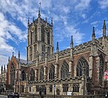
The county has an area of 2,479 km2 (957 sq mi) and a population of 600,259. Kingston upon Hull is by far the largest settlement, with population of 267,014, and is a major port and the county's economic and transport centre. The rest of the county is largely rural, and the next largest towns are the seaside resort of Bridlington (35,369) and the historic town of Beverley (30,351). The county is governed by two unitary authorities, East Riding of Yorkshire Council and Hull City Council. It takes its name from the East Riding, a historic subdivision of Yorkshire.
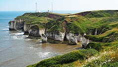
In the east of the county the low-lying plain of Holderness is enclosed by a crescent of low chalk hills, the Yorkshire Wolds. The Wolds meet the sea at Flamborough Head, a chalk headland, while the Holderness coast to the south is characterised by clay cliffs. The west of the county is part of the Vale of York, the wide plain of the River Ure/Ouse; the south-west is part of the Humberhead Levels.
- ^ "Lord-Lieutenant". East Riding of Yorkshire Council. Retrieved 25 November 2020.
- ^ "No. 63990". The London Gazette. 9 March 2023. p. 4634.
© MMXXIII Rich X Search. We shall prevail. All rights reserved. Rich X Search


