| Edwin Andrews Air Base | |
|---|---|
San Roque Air Field Moret Field | |
| Zamboanga City, Zamboanga, Philippines | |
| Coordinates | 06°55′31″N 122°03′39″E / 6.92528°N 122.06083°E |
| Type | Air Base |
| Site information | |
| Owner | |
| Controlled by | Philippine Air Force |
| Condition | active, as of 2014 |
| Site history | |
| Built by | |
| In use | December 6, 1956-present |
| Garrison information | |
| Garrison |
|
Airfield Information | |||||||||||
|---|---|---|---|---|---|---|---|---|---|---|---|
| Summary | |||||||||||
| Airport type | Military | ||||||||||
| Operator | Philippine Air Force | ||||||||||
| Location | Zamboanga City, Zamboanga, Philippines | ||||||||||
| Elevation AMSL | 6 m / 20 ft | ||||||||||
| Coordinates | 6°55′21″N 122°3′35″E / 6.92250°N 122.05972°E | ||||||||||
| Map | |||||||||||
| Runways | |||||||||||
| |||||||||||
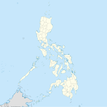
Edwin Andrews Air Base (ICAO: RPMZ) is located in Zamboanga, Philippines. The base operates through Runway 09/27, which has a length of 2,611 m (8,566 ft), along with the Zamboanga International Airport and conducts air operations against insurgents like the Moro Islamic Liberation Front.
© MMXXIII Rich X Search. We shall prevail. All rights reserved. Rich X Search

