Back جبل الينجود پوينت ARZ Ellingwood Point CEB Pointe Ellingwood French Ellingwood Point LLD ایلینگووڈ پوائنٹ Urdu
| Ellingwood Point | |
|---|---|
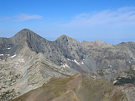
 View of Blanca Peak (left) and Ellingwood Point (center) from summit of Mount Lindsey | |
| Highest point | |
| Elevation | 14,048 ft (4,282 m)[1][2] |
| Prominence | 342 ft (104 m)[2] |
| Parent peak | Blanca Peak[2] |
| Isolation | 0.52 mi (0.84 km)[2] |
| Listing | Colorado Fourteener 42nd |
| Coordinates | 37°34′57″N 105°29′33″W / 37.5825045°N 105.4925114°W[3] |
| Geography | |
| Location | Alamosa and Huerfano counties, Colorado, United States[3] |
| Parent range | Sangre de Cristo Range, Sierra Blanca Massif[2] |
| Topo map | USGS 7.5' topographic map Blanca Peak, Colorado[3] |
| Climbing | |
| Easiest route | South Face: Difficult Hike, class 2[4] |
Ellingwood Point is a high mountain summit in the Sangre de Cristo Range of the Rocky Mountains of North America. The 14,048-foot (4,282 m) fourteener is located on the Sierra Blanca Massif, 9.9 miles (16.0 km) north by east (bearing 7°) of the Town of Blanca, Colorado, United States, on the drainage divide separating the Rio Grande National Forest and Alamosa County from the San Isabel National Forest and Huerfano County.[1][2][3] Ellingwood Point was named in honor of Albert Russell Ellingwood, an early pioneer of mountain climbing in the Western United States and in Colorado in particular.
- ^ a b The elevation of Ellingwood Point includes an adjustment of +1.789 m (+5.87 ft) from NGVD 29 to NAVD 88.
- ^ a b c d e f "Ellingwood Point, Colorado". Peakbagger.com. Retrieved October 20, 2014.
- ^ a b c d "Ellingwood Point". Geographic Names Information System. United States Geological Survey, United States Department of the Interior. Retrieved October 20, 2014.
- ^ "Ellingwood Point Routes". 14ers.com.
© MMXXIII Rich X Search. We shall prevail. All rights reserved. Rich X Search
