Back قلعة إريبوني Arabic Castiellu d'Erebuni AST Erebuni AVK Erebuni qalası Azerbaijani Эребуни Bashkir Эрэбуні Byelorussian Еребуни (крепост) Bulgarian Castell d'Erebuni Catalan Erebuni Czech Erebuni German
 Walls of Erebuni Fortress | |
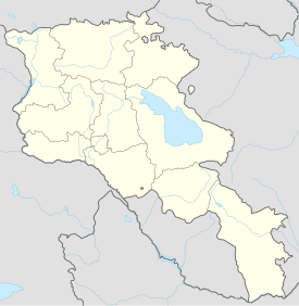
| Location | Between the Nor Aresh District and Vardashen District, Yerevan, Armenia |
|---|---|
| Coordinates | 40°08′26″N 44°32′17″E / 40.1406°N 44.5381°E |
| Type | fortified settlement |
| Height | Site sits approximately 1,017 metres (3,335 ft) above sea level. Arin Berd hill is 65 metres (215 ft) above ground level. |
| History | |
| Builder | King Argishti I |
| Material | stone (foundation/lower walls), adobe brick (upper walls), |
| Founded | 782 B.C. |
| Cultures | Kingdom of Urartu:Yervandian, Marian and Achaemenid |
| Site notes | |
| Excavation dates | Late 19th-century, 1950–1968, 2008-Present |
| Archaeologists | A. Ivanovsky (19th c.), Konstantine Hovhannisyan and Boris Piotrovsky (1950–1968) |
| Condition | Ruins; Extant foundations and lower walls, sections of the site remain to be excavated. |
| Ownership | City of Yerevan, public property |
| Management | Erebuni Historical & Archaeological Museum-Reserve; separate entry fees are required for museum and fortress |
| Public access | Yes |
| Website | Erebuni Historical & Archaeological Reserve: Erebuni |
| Active excavation | |
Erebuni Fortress (Armenian: Էրեբունի ամրոց, romanized: Erebuni amrots') is an Urartian fortified city, located in Yerevan, Armenia. It is 1,017 metres (3,337 ft) above sea level.[1] It was one of several fortresses built along the northern Urartian border and was one of the most important political, economic and cultural centers of the vast kingdom. The name Yerevan itself is derived from Erebuni.[2]
- ^ elevationmap.net. "Mahari Street Yerevan Armenia on the Elevation Map. Topographic Map of Mahari Street Yerevan Armenia". elevationmap.net.
- ^ Israelyan, Margarit A (1971). Էրեբունի: Բերդ-Քաղաքի Պատմություն (Erebuni: The History of a Fortress-City) (in Armenian). Yerevan: Hayastan Publishing Press. pp. 8–15.
© MMXXIII Rich X Search. We shall prevail. All rights reserved. Rich X Search
