Back Valsbaai Afrikaans False Bay Catalan False Bay (luuk sa Habagatang Aprika, Province of the Western Cape) CEB False Bay Czech False Bay Danish False Bay German Bahía Falsa Spanish Baie False French Baía Falsa Galician מפרץ פולס HE
| False Bay | |
|---|---|
| Valsbaai (Afrikaans) | |
 Astronaut photo of Cape Town with False Bay | |
| Coordinates | 34°13′47″S 18°38′43″E / 34.22972°S 18.64528°E |
| River sources | Buffels River, Cape Peninsula, Buffels River, Pringle Bay, Eerste River, Elsjes River, Lourens River, Rooiels River, Sandvlei estuary, Silvermaine River, Steenbras River |
| Ocean/sea sources | Southern Atlantic Ocean |
| Basin countries | South Africa |
| Max. length | 30 kilometres (19 mi) |
| Max. width | 30 kilometres (19 mi) |
| Surface area | 1,090 square kilometres (420 sq mi) |
| Max. depth | 90 metres (300 ft) |
| Water volume | 45 cubic kilometres |
| Shore length1 | 116 kilometres (72 mi) |
| Islands | Seal island |
| Settlements | City of Cape Town |
| 1 Shore length is not a well-defined measure. | |
volume(Infobox body of water).
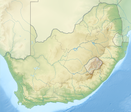
False Bay (Afrikaans: Valsbaai) is a body of water in the Atlantic Ocean between the mountainous Cape Peninsula and the Hottentots Holland Mountains in the extreme south-west of South Africa. The mouth of the bay faces south and is demarcated by Cape Point to the west and Cape Hangklip to the east. The north side of the bay is the low-lying Cape Flats, and the east side is the foot of the Hottentots Holland Mountains to Cape Hangklip which is at nearly the same latitude as Cape Point. In plan the bay is approximately square, being roughly the same extent from north to south as east to west, with the southern side open to the ocean. The seabed generally slopes gradually down from north to south, and is mostly fairly flat unconsolidated sediments. Much of the bay is off the coast of the City of Cape Town, and it includes part of the Table Mountain National Park Marine Protected Area and the whole of the Helderberg Marine Protected Area. The name "False Bay" was applied at least three hundred years ago by sailors returning from the east who confused Cape Point and Cape Hangklip, which are somewhat similar in profile when approached from the southeast.[1]
False Bay is at the extreme western end of the inshore Agulhas marine ecoregion which extends from Cape Point to the Mbashe river over the continental shelf, in the overlap zone between Cape Agulhas and Cape Point where the warm Agulhas Current and the cooler South Atlantic waters mix. The continental shelf is at its widest in this ecoregion, extending up to 240 km (150 mi) offshore on the Agulhas Bank, but is considerably narrower off False Bay. This ecoregion has the highest number of South African marine endemics, and is a breeding area for many species. The transition between the Agulhas ecoregion and the cooler Benguela ecoregion is at Cape Point, on the western boundary of False Bay.
False Bay also contains South Africa's largest naval base at Simon's Town (historically a base for the Royal Navy),[2] and small fishing harbours at Kalk Bay and Gordon's Bay.[3]
© MMXXIII Rich X Search. We shall prevail. All rights reserved. Rich X Search

