Farradiyya
الفرّاضية | |
|---|---|
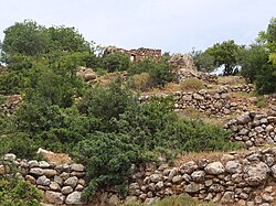
 General view of village Farradiyya | |
A series of historical maps of the area around Farradiyya (click the buttons) | |
Location within Mandatory Palestine | |
| Coordinates: 32°55′54″N 35°25′42″E / 32.93167°N 35.42833°E | |
| Palestine grid | 190/259 |
| Geopolitical entity | Mandatory Palestine |
| Subdistrict | Safad |
| Date of depopulation | February 1949[5] |
| Area | |
| • Total | 19,947 dunams (20.0 km2 or 7.7 sq mi) |
| Population (1945) | |
| • Total | 670[3][4] |
| Cause(s) of depopulation | Expulsion by Yishuv forces |
| Current Localities | Parod, Shefer |
Farradiyya (Arabic: الفرّاضية, al-Farâdhiyyah) was a Palestinian Arab village of 670 located 8 kilometers (5.0 mi) southwest of Safad,[6] A Jewish settlement called 'Farod' was built atop the once ruined village.
Farradiyya was situated on the southern slopes of Mount Zabud with an average elevation of 375 meters (1,230 ft) above sea level. The Safad-Nazareth highway (Route 866) passed it to the north.[6] Its total land area was 19,747 dunams, of which 25 dunams were built-up areas and 5,365 dunams cultivable.[4]
In 1949, a kibbutz named Parod, after the village's ancient name, was founded nearby.
- ^ Guérin, 1880, Galilee II, p. 456
- ^ Palmer, 1881, p.72
- ^ Government of Palestine, Department of Statistics, 1945, p. 9
- ^ a b Government of Palestine, Department of Statistics. Village Statistics, April, 1945. Quoted in Hadawi, 1970, p. 69.
- ^ Morris, 2004, p. xvii, village #70. Also provides cause of depopulation.
- ^ a b Khalidi, 1992, p.449.
© MMXXIII Rich X Search. We shall prevail. All rights reserved. Rich X Search


