Back فاونتن إنن Arabic فاونتن این، گونئی کارولینا AZB Fountain Inn Catalan Фаунтен-Инн (Къилба Каролина) CE Fountain Inn CEB Fountain Inn, De Carolina Welsh Fountain Inn (South Carolina) Danish Fountain Inn (South Carolina) German Fountain Inn Spanish فاونتن این، کارولینای جنوبی Persian
Fountain Inn | |
|---|---|
 Top, left to right: Downtown Fountain Inn, Fountain Inn City Hall, Cannon Building, Fairview Presbyterian Church, Robert Quillen Office and Library | |
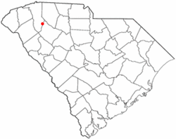
 Location of Fountain Inn, South Carolina | |
| Coordinates: 34°41′36″N 82°11′55″W / 34.69333°N 82.19861°W | |
| Country | United States |
| State | South Carolina |
| Counties | Greenville, Laurens |
| Area | |
| • Total | 8.50 sq mi (22.01 km2) |
| • Land | 8.45 sq mi (21.89 km2) |
| • Water | 0.05 sq mi (0.13 km2) |
| Elevation | 866 ft (264 m) |
| Population | |
| • Total | 10,416 |
| • Density | 1,232.52/sq mi (475.90/km2) |
| Time zone | UTC−5 (Eastern (EST)) |
| • Summer (DST) | UTC−4 (EDT) |
| ZIP code | 29644 |
| Area code | 864 |
| FIPS code | 45-27070[4] |
| GNIS feature ID | 1222514[2] |
| Website | www |
Fountain Inn is a city in Greenville and Laurens counties in the U.S. state of South Carolina. The population was 10,416 at the 2020 census,[5] up from 7,799 in 2010. It is part of the Greenville-Mauldin-Easley Metropolitan Statistical Area.
- ^ "ArcGIS REST Services Directory". United States Census Bureau. Retrieved October 15, 2022.
- ^ a b U.S. Geological Survey Geographic Names Information System: Fountain Inn, South Carolina
- ^ Cite error: The named reference
USCensusDecennial2020CenPopScriptOnlywas invoked but never defined (see the help page). - ^ "U.S. Census website". United States Census Bureau. Retrieved January 31, 2008.
- ^ "Geographic Identifiers: 2010 Demographic Profile Data (G001): Fountain Inn city, South Carolina". American Factfinder. U.S. Census Bureau. Retrieved February 8, 2017.[dead link]
© MMXXIII Rich X Search. We shall prevail. All rights reserved. Rich X Search

