Front Range Urban Corridor | |
|---|---|
 | |
 | |
| Coordinates: 39°44′21″N 104°59′06″W / 39.7392°N 104.9850°W | |
| Country | |
| States | |
| Largest city | - Denver |
| Other principal cities |
|
| Area | |
| • Total | 65,150 km2 (25,153 sq mi) |
| Population | 5,055,344 |
| GDP | |
| • Total | $378.020 billion (2022) |
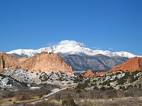
The Front Range Urban Corridor is an oblong region of urban population located along the eastern face of the Southern Rocky Mountains, encompassing 18 counties in the US states of Colorado and Wyoming. The corridor derives its name from the Front Range, the mountain range that defines the western boundary of the corridor which serves as a gateway to the Rocky Mountains. The region comprises the northern portion of the Southern Rocky Mountain Front geographic area, which in turn comprises the southern portion of the Rocky Mountain Front geographic area of Canada and the United States. The Front Range Urban Corridor had a population of 5,055,344 at the 2020 Census, an increase of +16.65% since the 2010 Census.[2]
The corridor contains some of the West's largest cities, such as Denver and Colorado Springs. It also contains smaller cities such as Pueblo and Cheyenne. Its main transportation corridor is Interstate 25. There have been many proposals for Front Range Passenger Rail. None have come to fruition as of 2021[update], though plans are under development.[3]
- ^ "Gross Domestic Product by County and Metropolitan Area, 2022" (PDF). www.bea.gov. Bureau of Economic Analysis.
- ^ "QuickFacts". United States Census Bureau. Retrieved November 11, 2021.
- ^ "Report: Front Range Passenger Rail Moving Forward". Railway Age. 2021-07-01. Retrieved 2021-12-20.
© MMXXIII Rich X Search. We shall prevail. All rights reserved. Rich X Search
