Back حي كانغنام Arabic حى كانجنام ARZ Qannam Azerbaijani قانقنیم محلهسی AZB Gangnam-gu CEB Kangnam Czech Gangnam-gu German Gangnam-gu Esperanto Gangnam-gu Spanish Gangnami ringkond Estonian
You can help expand this article with text translated from the corresponding article in Korean. (September 2017) Click [show] for important translation instructions.
|
Gangnam
| |
|---|---|
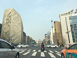
 Teheran-ro and Yeongdong-daero streets seen from Park Hyatt Seoul. | |
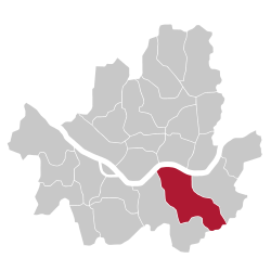
 Location of Gangnam-gu in Seoul | |
| Coordinates: 37°29′48″N 127°01′39″E / 37.49667°N 127.02750°E | |
| Country | |
| Region | Sudogwon |
| Special City | Seoul |
| Administrative dong | 26 |
| Government | |
| • Body | Gangnam-gu Council |
| • Mayor | Cho Seong-myeong (People Power) |
| • MNAs | List of MNAs |
| Area | |
| • Total | 39.49 km2 (15.25 sq mi) |
| Population (November, 2020)[1] | |
| • Total | 508,135 |
| • Density | 13,000/km2 (33,000/sq mi) |
| Time zone | UTC+9 (Korea Standard Time) |
| Postal code. | 06000 ~ 06499 |
| Area code(s) | +82-2-2226,400,500 |
| Website | gangnam.go.kr |
 | |


Gangnam District (Korean: 강남구; Hanja: 江南區; RR: Gangnam-gu; IPA: [ka̠ŋna̠m.gu]) is one of the 25 districts of Seoul, South Korea. The term Gangnam translates to "South of the [Han] River". Gangnam District is the third largest district in Seoul, with an area of 39.5 km2 (15.3 sq mi). As of the 2017 census, Gangnam District had a population of 561,052.[1] There is a high concentration of wealth in the district, with prices for an apartment as of 2020 nearly double those in the rest of Seoul. Gangnam District is part of Gangnam School District Eight, along with the Seocho District. This district shares half of Gangnam-daero Gangnam Station area with Seocho District, which is one of the most crowded places in South Korea.[2]
- ^ a b https://www.citypopulation.de/php/southkorea-admin.php?adm2id=11230%7C Gangnam-gu (City District, Seoul, South Korea) - Population Statistics ... - Retrieved 23-03-01
- ^ "Gangnam apartment prices jump 84 times in 40 years". 29 March 2020.
© MMXXIII Rich X Search. We shall prevail. All rights reserved. Rich X Search
