Back Gasherbrum II Afrikaans جبل جاشربرم-2 Arabic جبل جاشربرم 2 ARZ Gasherbrum II AST Гашэрбрум II Byelorussian Гашербрум II Bulgarian গাশারব্রুম ২ Bengali/Bangla Gasherbrum II BS Gasherbrum II Catalan Gasherbrum II Feng CEB
| Gasherbrum II | |
|---|---|
| گاشر برم-2 K4 | |
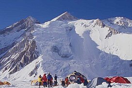
 Gasherbrum II from Base Camp | |
| Highest point | |
| Elevation | 8,035 m (26,362 ft)[1][2][3][4] Ranked 13th |
| Prominence | 1,524 m (5,000 ft)[2] |
| Listing | Eight-thousander Ultra |
| Coordinates | 35°45′30″N 76°39′12″E / 35.75833°N 76.65333°E[5] |
| Geography | |
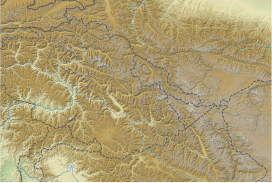
| Location | Baltistan, Gilgit–Baltistan, Pakistan Tashkurgan, Xinjiang, China, China–Pakistan border |
| Parent range | Karakoram |
| Climbing | |
| First ascent | July 7, 1956, by Fritz Moravec, Josef Larch and Hans Willenpart[2] |
| Easiest route | Snow/ice climb |
 | |
Gasherbrum II (Balti: རྒ་ཥཱ་བྲུམ་། - ༢, romanized: rgasha brum 2, lit. 'Beautiful Mountain 2'; Urdu: گاشر برم - ۲; simplified Chinese: 加舒尔布鲁木II峰; traditional Chinese: 加舒爾布魯木II峰; pinyin: Jiāshūěrbùlǔmù II Fēng); surveyed as K4, is the 13th highest mountain in the world at 8,035 metres (26,362 ft) above sea level.[1][2][3][4][6] It is the third-highest peak of the Gasherbrum massif, and is located in the Karakoram, on the border between Gilgit–Baltistan, Pakistan and Xinjiang, China.[4] The mountain was first climbed on July 7, 1956, by an Austrian expedition which included Fritz Moravec, Josef Larch, and Hans Willenpart.
- ^ a b "General Info".
- ^ a b c d Cite error: The named reference
peakbaggerwas invoked but never defined (see the help page). - ^ a b Cite error: The named reference
cknpwas invoked but never defined (see the help page). - ^ a b c Cite error: The named reference
peakwarewas invoked but never defined (see the help page). - ^ Cite error: The named reference
peaklistwas invoked but never defined (see the help page). - ^ "Gasherbrum II". SummitPost.org. Retrieved 9 March 2013.
© MMXXIII Rich X Search. We shall prevail. All rights reserved. Rich X Search


