Back গৌরীশঙ্কর সংরক্ষিত অঞ্চল Bengali/Bangla गौरीशंकर संरक्षण क्षेत्र DTY गौरीशङ्कर संरक्षण क्षेत्र Nepali
| Gaurishankar Conservation Area | |
|---|---|
IUCN category VI (protected area with sustainable use of natural resources) | |
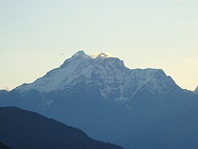
 View of Gaurishankar | |
| Location | Nepal |
| Coordinates | 27°52′N 86°11′E / 27.87°N 86.18°E |
| Area | 2,179 km2 (841 sq mi) |
| Established | 11 January 2010 |
| Governing body | Department of National Parks and Wildlife Conservation |

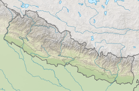
Gaurishankar Conservation Area is a protected area in the Himalayas of Nepal that was established in January 2010, covering 2,179 km2 (841 sq mi) in the Ramechhap, Dolakha and Sindhupalchok districts and encompassing 22 Village Development Committees. It is contiguous with Tibet in the north and a part of the Sacred Himalayan Landscape.[1][2] The protected area connects the Langtang and Sagarmatha National Parks.[3] In 2010, the Government of Nepal handed over the management of Gaurishankar Conservation Area to National Trust for Nature Conservation for 20 years, which has been managing the area through its Gaurishankar Conservation Area Project.[2]
- ^ World Wildlife Fund (2012). "Nepal REDD+ Readiness" (PDF). WWF Nepal. Archived (PDF) from the original on 2015-06-19. Retrieved 2015-06-19.
- ^ a b NTNC (2010). Gaurishankar Conservation Area Project Archived 2019-06-03 at the Wayback Machine. National Trust for Nature Conservation, Nepal.
- ^ Bhuju, U. R.; Shakya, P. R.; Basnet, T. B.; Shrestha, S. (2007). Nepal Biodiversity Resource Book. Protected Areas, Ramsar Sites, and World Heritage Sites (PDF). Kathmandu: International Centre for Integrated Mountain Development, Ministry of Environment, Science and Technology, in cooperation with United Nations Environment Programme, Regional Office for Asia and the Pacific. ISBN 978-92-9115-033-5. Archived from the original (PDF) on 2011-07-26. Retrieved 2018-12-14.
© MMXXIII Rich X Search. We shall prevail. All rights reserved. Rich X Search
