Back سد وادي جلين Arabic Presa de Glen Canyon Catalan Glen Canyon Dam CEB Glen Canyon Dam German Presa del Cañón de Glen Spanish سد گلن کنیون Persian Glen Canyonin vesivoimalaitos Finnish Barrage de Glen Canyon French סכר קניון גלן HE Glen Canyon gát Hungarian
| Glen Canyon Dam | |
|---|---|
 Glen Canyon Dam and Bridge, looking upstream | |
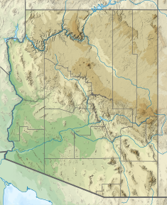
Location in the United States Location in Arizona | |
| Country | United States |
| Location | Coconino County, Arizona |
| Coordinates | 36°56′15″N 111°29′04″W / 36.93750°N 111.48444°W |
| Construction began | 1956 |
| Opening date | 1966 |
| Construction cost | $135 million ($969 million in 2023 dollars[1]) |
| Owner(s) | U.S. Bureau of Reclamation |
| Dam and spillways | |
| Type of dam | Arch-gravity dam |
| Impounds | Colorado River |
| Height (foundation) | 710 ft (220 m)[2] |
| Length | 1,560 ft (480 m)[2] |
| Elevation at crest | 3,715 ft (1,132 m)[2] |
| Spillway type | Tunnel, gated |
| Spillway capacity | 208,000 cu ft/s (5,900 m3/s)[3] |
| Reservoir | |
| Creates | Lake Powell |
| Total capacity | 25,160,000 acre⋅ft (31.03 km3)[4] |
| Catchment area | 108,335 sq mi (280,590 km2)[3] |
| Surface area | 161,390 acres (65,310 ha)[5] |
| Power Station | |
| Commission date | 1964 (first 2 units)[6] |
| Turbines | 8 x 254,000 hp Francis turbines[6] |
| Installed capacity | 1,320 MW[6] |
| Annual generation | 4,717 GWh[7] |
Glen Canyon Dam is a concrete arch-gravity dam in the southwestern United States, located on the Colorado River in northern Arizona, near the city of Page. The 710-foot-high (220 m) dam was built by the Bureau of Reclamation (USBR) from 1956 to 1966 and forms Lake Powell, one of the largest man-made reservoirs in the U.S. with a capacity of more than 25 million acre-feet (31 km3).[4] The dam is named for Glen Canyon, a series of deep sandstone gorges now flooded by the reservoir; Lake Powell is named for John Wesley Powell, who in 1869 led the first expedition to traverse the Colorado River's Grand Canyon by boat.
A dam in Glen Canyon was studied as early as 1924, but these plans were initially dropped in favor of the Hoover Dam (completed in 1936) which was located in the Black Canyon. By the 1950s, due to rapid population growth in the seven U.S. and two Mexican states comprising the Colorado River Basin, the Bureau of Reclamation deemed the construction of additional reservoirs necessary.[8] The Glen Canyon Dam remains a central issue for modern environmentalist movements. Beginning in the late 1990s, the Sierra Club and other organizations renewed the call to dismantle the dam and drain Lake Powell in Lower Glen Canyon. Glen Canyon and Lake Powell are managed by the Department of the Interior within Glen Canyon National Recreation Area.
Since first filling to capacity in 1980, Lake Powell water levels have fluctuated greatly depending on water demand and annual runoff. The operation of Glen Canyon Dam helps ensure an equitable distribution of water between the states of the Upper Colorado River Basin (Colorado, Wyoming, and most of New Mexico and Utah) and the Lower Basin (California, Nevada and most of Arizona).[8] During years of drought, Glen Canyon guarantees a water delivery to the Lower Basin states, without the need for rationing in the Upper Basin. In wet years, it captures extra runoff for future use.[8] The dam is also a major source of hydroelectricity, averaging over 4 billion kilowatt hours per year.[7] The long and winding Lake Powell, known for its scenic beauty and recreational opportunities including houseboating, fishing and water skiing, attracts millions of tourists each year to the Glen Canyon National Recreation Area.[9]
In addition to its flooding of the scenic Glen Canyon, the dam's economic justification was questioned by some critics.[10] It became "a catalyst for the modern environmental movement,"[11] and was one of the last dams of its size to be built in the United States.[12] The dam has been criticized for the large evaporative losses from Lake Powell and its impact on the ecology of the Grand Canyon, which lies downstream; environmental groups continue to advocate for the dam's removal. Water managers and utilities state that the dam is a major source of renewable energy and provides a buffer for severe droughts.

- ^ Johnston, Louis; Williamson, Samuel H. (2023). "What Was the U.S. GDP Then?". MeasuringWorth. Retrieved November 30, 2023. United States Gross Domestic Product deflator figures follow the MeasuringWorth series.
- ^ a b c "Glen Canyon Dam Dimensions". U.S. Bureau of Reclamation. Archived from the original on March 3, 2016. Retrieved August 29, 2016.
- ^ a b "Glen Canyon Dam Hydraulics & Hydrology". U.S. Bureau of Reclamation. Archived from the original on September 5, 2015. Retrieved August 29, 2016.
- ^ a b "Lake Powell's storage capacity updated for first time since 1986". U.S. Geological Survey. March 21, 2022. Retrieved June 6, 2022.
- ^ Cite error: The named reference
overviewwas invoked but never defined (see the help page). - ^ a b c "Glen Canyon Powerplant". U.S. Bureau of Reclamation. Archived from the original on September 5, 2015. Retrieved August 29, 2016.
- ^ a b Cite error: The named reference
longtermplanwas invoked but never defined (see the help page). - ^ a b c Cite error: The named reference
CRSPwas invoked but never defined (see the help page). - ^ Cite error: The named reference
USBRlakepowellwas invoked but never defined (see the help page). - ^ Needham, p. 202
- ^ "History of the Environmental Movement". Glen Canyon Institute. Retrieved August 31, 2016.
- ^ Martin, p. 3
© MMXXIII Rich X Search. We shall prevail. All rights reserved. Rich X Search

