Back مقاطعة غراتيوت (ميشيغان) Arabic Gratiot County, Michigan BAR Грашит (окръг, Мичиган) Bulgarian গ্রাটিওট কাউন্টি, মিশিগান BPY Gratiot Gông (Michigan) CDO Gratiot County CEB Gratiot County Czech Gratiot County, Michigan Welsh Gratiot County German Kantono Gratiot Esperanto
Gratiot County | |
|---|---|
 | |
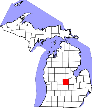
 Location within the U.S. state of Michigan | |
 Michigan's location within the U.S. | |
| Coordinates: 43°17′N 84°36′W / 43.29°N 84.6°W | |
| Country | |
| State | |
| Founded | 1855[1] |
| Named for | Charles Gratiot |
| Seat | Ithaca |
| Largest city | Alma |
| Area | |
| • Total | 572 sq mi (1,480 km2) |
| • Land | 568 sq mi (1,470 km2) |
| • Water | 3.1 sq mi (8 km2) 0.6% |
| Population (2020) | |
| • Total | 41,761 |
| • Density | 75/sq mi (29/km2) |
| Time zone | UTC−5 (Eastern) |
| • Summer (DST) | UTC−4 (EDT) |
| Congressional district | 2nd |
| Website | https://www.gratiotmi.com/ |
Gratiot County (/ˈɡræʃɪt/ GRASH-it) is a county in the U.S. state of Michigan. As of the 2020 Census, the population was 41,761.[2] The county seat is Ithaca,[3] although its most populous city is Alma.
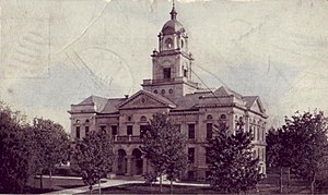
Gratiot County comprises the Alma, MI Micropolitan Statistical Area, which is also part of the Mount Pleasant-Alma, MI Combined Statistical Area. The Gratiot County Courthouse was designed in the classical revival style by Claire Allen, a prominent southern Michigan architect. It is one of seven sites in the county listed on the National Register of Historic Places (No. 76002291 added 1976).[4] In June 2012, the 212.8 MW Gratiot County Wind Project opened, the largest wind power installation in the state.[5]
- ^ Cite error: The named reference
clarkewas invoked but never defined (see the help page). - ^ "State & County QuickFacts". US Census Bureau. Retrieved September 15, 2021.
- ^ "Find a County". National Association of Counties. Archived from the original on May 31, 2011. Retrieved June 7, 2011.
- ^ "National Register of Historical Places - Gratiot County MI".
- ^ Michigan's Largest Wind Farm Enters Commercial Operation, North American Winpower, June 6, 2012
© MMXXIII Rich X Search. We shall prevail. All rights reserved. Rich X Search
