This article needs additional citations for verification. (February 2024) |
Griffintown | |
|---|---|
 Mountain Street in Griffintown | |
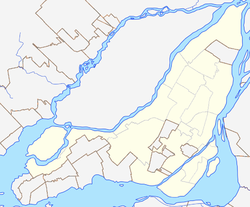
Location of Griffintown in Montreal | |
| Coordinates: 45°29′15″N 73°34′00″W / 45.48756°N 73.56677°W | |
| Country | Canada |
| Province | Quebec |
| City | Montreal |
| Borough | Le Sud-Ouest |
| Area | |
| • Land | 1.31 km2 (0.51 sq mi) |
| Elevation | 20 m (70 ft) |
| Population | |
| • Total | 6,446 |
| • Density | 4,920.6/km2 (12,744/sq mi) |
| • Change (2006-11) | |
| • Dwellings | 4,714 |
| Postal Code | |
| Area code(s) | 514, 438 |
Griffintown is a historic neighbourhood of Montreal, Quebec, southwest of downtown. The area existed as a functional neighbourhood from the 1820s until the 1960s and was mainly populated by Irish immigrants and their descendants. Mostly depopulated since then, the neighbourhood has been undergoing redevelopment since the early 2010s.
Griffintown is the portion of the ward of St. Ann north of the Lachine Canal; the part south of the canal is now part of Pointe-Saint-Charles. This part of the ward was delimited by Notre-Dame Street to the north, the Bonaventure Expressway to the east, and a short segment of the city limit between Notre-Dame Street and the canal west of the St. Gabriel Locks to the west.[3] It was the earliest and largest faubourg annexed to Old Montreal before the introduction of the tram car in the 1840s.
- ^ a b "Census Profile: Census Tract: 4620070.00". Canada 2011 Census. Statistics Canada. 8 February 2012. Retrieved 1 April 2012.
- ^ a b "Census Profile: Census Tract: 4620069.00". Canada 2011 Census. Statistics Canada. 8 February 2012. Retrieved 2 April 2012.
- ^ Pinsoneault, Adolphe Rodrigue. Atlas of the island and city of Montreal and Ile Bizard : a compilation of the most recent cadastral plans from the book of reference. Atlas Publishing Co. Ltd: 1907. Pp. 22. Available online[permanent dead link] from Bibliothèque et Archives nationales du Québec. Accessed July 5, 2011.
© MMXXIII Rich X Search. We shall prevail. All rights reserved. Rich X Search

