| Harbledown | |
|---|---|
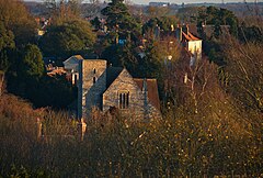
 St Nicholas' Church in Harbledown | |
Location within Kent | |
| Area | 2.92 sq mi (7.6 km2) |
| Population | 2,656 (2011 Ward)[1] |
| • Density | 910/sq mi (350/km2) |
| OS grid reference | TR130579 |
| Civil parish |
|
| District | |
| Shire county | |
| Region | |
| Country | England |
| Sovereign state | United Kingdom |
| Post town | CANTERBURY |
| Postcode district | CT2 |
| Dialling code | 01227 |
| Police | Kent |
| Fire | Kent |
| Ambulance | South East Coast |
| UK Parliament | |
Harbledown is a village in Kent, England, immediately west of Canterbury and contiguous with the city. At local government level the village is designated as a separate civil parish, that of Harbledown and Rough Common. The High Street is a conservation area with many listed buildings, including a tall and intact Georgian terrace on the south side. The area includes several orchards for fruit on its outskirts, within the parish boundaries.
- ^ "Canterbury Ward population 2011". Retrieved 2 October 2015.
© MMXXIII Rich X Search. We shall prevail. All rights reserved. Rich X Search

