Hosanger Municipality
Hosanger herad | |
|---|---|
 View of the lake Kossdalsvatnet | |
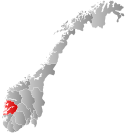
 Hordaland within Norway | |
 Hosanger within Hordaland | |
| Coordinates: 60°34′30″N 05°28′39″E / 60.57500°N 5.47750°E | |
| Country | Norway |
| County | Hordaland |
| District | Nordhordland |
| Established | 1 Jan 1838 |
| • Created as | Formannskapsdistrikt |
| Disestablished | 1 Jan 1964 |
| • Succeeded by | Osterøy and Lindås municipalities |
| Administrative centre | Hosanger |
| Area (upon dissolution) | |
| • Total | 228 km2 (88 sq mi) |
| Population (1964) | |
| • Total | 2,442 |
| • Density | 11/km2 (28/sq mi) |
| Time zone | UTC+01:00 (CET) |
| • Summer (DST) | UTC+02:00 (CEST) |
| ISO 3166 code | NO-1253[1] |
Hosanger is a former municipality in the old Hordaland county, Norway. The municipality existed from 1838 until its dissolution in 1964. The municipality was located in what is now parts of Alver Municipality and Osterøy Municipality in Vestland county. It originally covered all the lands on both sides of the Osterfjorden-Romarheimsfjorden from the Lonevågen fjord all the way east to the county border at the end of the Modalen valley. Hosanger also included an exclave on the Lindås peninsula surrounding the village of Seim at the southern end of the Lurefjorden. Seim was separated from the rest of Hosanger by part of Lindås Municipality. Over time, the areas of Seim and Modalen were split off from Hosanger. The administrative centre of the municipality was the village of Hosanger on the island of Osterøy, where Hosanger Church is located.[2]
- ^ Bolstad, Erik; Thorsnæs, Geir, eds. (26 January 2023). "Kommunenummer". Store norske leksikon (in Norwegian). Kunnskapsforlaget.
- ^ Store norske leksikon. "Hosanger" (in Norwegian). Retrieved 23 April 2014.
© MMXXIII Rich X Search. We shall prevail. All rights reserved. Rich X Search
