Back Huadu AST Districte de Huadu Catalan Huă-dŭ-kṳ̆ CDO Huadu Qu CEB Chua-tu Czech Huadu German Huadu Spanish Huadu Barrutia Basque ناحیه هوادو Persian District de Huadu French
This article needs additional citations for verification. (January 2010) |
Huadu
花都区 Huaxian | |
|---|---|
 Hongshan in Huadu District | |
 | |
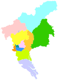
 Huadu District in Guangzhou | |
| Coordinates: 23°22′37.99″N 113°11′46.00″E / 23.3772194°N 113.1961111°E | |
| Country | People's Republic of China |
| Province | Guangdong |
| Sub-provincial city | Guangzhou |
| Area | |
| • Total | 961 km2 (371 sq mi) |
| Population (2020[1]) | |
| • Total | 1,642,360 |
| • Density | 1,700/km2 (4,400/sq mi) |
| Time zone | UTC+8 (China Standard) |
| Postal code | 510800 |
| Area code | 020 |
| Website | archived link |
| Huadu, Guangzhou | |||||||||||||||||
|---|---|---|---|---|---|---|---|---|---|---|---|---|---|---|---|---|---|
| Simplified Chinese | 花都区 | ||||||||||||||||
| Traditional Chinese | 花都區 | ||||||||||||||||
| Jyutping | faa1 dou1 keoi1 | ||||||||||||||||
| Hanyu Pinyin | Huādū Qū | ||||||||||||||||
| |||||||||||||||||
| Alternative Chinese name | |||||||||||||||||
| Chinese | 花都 | ||||||||||||||||
| Jyutping | faa1 dou1 | ||||||||||||||||
| Hanyu Pinyin | Huādū | ||||||||||||||||
| Literal meaning | flower capital | ||||||||||||||||
| |||||||||||||||||
| Second alternative Chinese name | |||||||||||||||||
| Simplified Chinese | 花县 | ||||||||||||||||
| Traditional Chinese | 花縣 | ||||||||||||||||
| Jyutping | faa1 jyun2 | ||||||||||||||||
| Hanyu Pinyin | Huāxiàn | ||||||||||||||||
| |||||||||||||||||
Huadu District is one of 11 urban districts of the prefecture-level city of Guangzhou, the capital of Guangdong, China. It is located in the far northern suburbs of the city.
Xinhua Town is the seat of local government, and of the district CCP committee.[2]
While the Cantonese dialect is universally spoken, about 1/3 of the population consists of Hakka dialect speaking peoples.[3] The district is the ancestral home of many Overseas Chinese.
Formerly known as Hua County, it was the hometown of many Taiping Rebellion leaders like Hong Xiuquan and Hong Rengan.
- ^ "Guangzhou: Subdivision". Retrieved 25 March 2024.
- ^ "A Survey of Huadu District". lifeofguangzhou.com. 2006.
Huadu district has a 720,000 population. It is the hometown of many overseas Chinese, and it has approximate 300,000 overseas Chinese and Hong Kong and Macao compatriots.
- ^ The People's Government of Huadu. A Brief Introduction to Huadu, Dialects and family names. Available at https://www.huadu.gov.cn/hdqzfywb/huaduinfo/survey/
© MMXXIII Rich X Search. We shall prevail. All rights reserved. Rich X Search