Back İndira burnu Azerbaijani ইন্দিরা পয়েন্ট Bengali/Bangla Indira Point Catalan Indira Point CEB Σημείο Ίντιρα Greek Punta Indira Spanish Pointe Indira French ઇન્દિરા પોઇન્ટ Gujarati इंदिरा पोइंट Hindi Ujung Indira ID
Indira Point | |
|---|---|
Village | |
| Coordinates: 6°46′50″N 93°49′33″E / 6.780621°N 93.8258513°E | |
| Country | |
| State | Andaman and Nicobar Islands |
| District | Nicobar |
| Tehsil | Great Nicobar |
| Elevation | 47 m (154 ft) |
| Population (2011) | |
| • Total | 27 |
| Time zone | UTC+5:30 (IST) |
| 2011 census code | 645188 |
Preview warning: Page using Template:Infobox settlement with unknown parameter "pushpin_map_caption1"
Preview warning: Page using Template:Infobox settlement with unknown parameter "pushpin_map1"
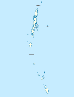
Indira Point, the southernmost point of India's territory,[1] is a village in the Nicobar district at Great Nicobar Island of Andaman and Nicobar Islands in India. It is located in the Great Nicobar tehsil.[2]
Rondo Island, Indonesia's northernmost island in Sabang district of Aceh province of Sumatra, lies 163 km south of Little Andaman Island,[3] and 145 km or 80 nautical miles from Indira Point. India and Indonesia are upgrading the deep sea port Sabang under the strategic military and economic collaboration to protect the channel between Great Nicobar Island and Rondo Island (c. May 2019),[4] which is 612 km or 330 nautical miles from Indira Point.
- ^ "Nicobar's bicycle diaries".
- ^ "Andaman and Nicobar Islands villages" (PDF). Land Records Information Systems Division, NIC. Archived from the original (PDF) on 4 March 2016. Retrieved 25 July 2015.
- ^ "Rondo Island, The Rich Uninhabited Island". Archived from the original on 3 November 2012. Retrieved 19 May 2018.
- ^ India seeks to aid Indonesia in developing port in Aceh, Economic Times, 19 May 2018.
© MMXXIII Rich X Search. We shall prevail. All rights reserved. Rich X Search

