Innvik Municipality
Innvik herad | |
|---|---|
| Indviken herred (historic name) | |
 View of the local Innvik Church | |
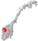
 Sogn og Fjordane within Norway | |
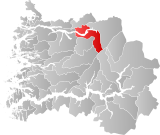
 Innvik within Sogn og Fjordane | |
| Coordinates: 61°51′06″N 06°37′00″E / 61.85167°N 6.61667°E | |
| Country | Norway |
| County | Sogn og Fjordane |
| District | Nordfjord |
| Established | 1 Jan 1838 |
| • Created as | Formannskapsdistrikt |
| Disestablished | 1 Jan 1965 |
| • Succeeded by | Stryn Municipality |
| Administrative centre | Innvik |
| Area (upon dissolution)[1] | |
| • Total | 511 km2 (197 sq mi) |
| Population (1965) | |
| • Total | 3,003 |
| • Density | 5.9/km2 (15/sq mi) |
| Time zone | UTC+01:00 (CET) |
| • Summer (DST) | UTC+02:00 (CEST) |
| ISO 3166 code | NO-1447[2] |
Innvik is a former municipality in the old Sogn og Fjordane county in Norway. The 511-square-kilometre (197 sq mi) municipality existed from 1838 until 1965. Innvik is located in the present-day Stryn Municipality in Vestland county, encompassing about the western third of the present municipality. Innvik included both sides of the Nordfjorden, from Randabygda in the west to just west of the village of Stryn. It stretched from the border with Hornindal Municipality in the north, through the Oldedalen valley all the way to the Jostedalsbreen glacier in the south.[1]
- ^ a b "Innvik i Sogn og Fjordane". Store norske leksikon (in Norwegian). Archived from the original on 8 October 2013. Retrieved 7 October 2013.
- ^ Bolstad, Erik; Thorsnæs, Geir, eds. (26 January 2023). "Kommunenummer". Store norske leksikon (in Norwegian). Kunnskapsforlaget.
© MMXXIII Rich X Search. We shall prevail. All rights reserved. Rich X Search
