Back جاكسونفيل (أركنساس) Arabic جاكسونفيل (بولاسكى, اركنسو) ARZ جکسنویل (آرکانزاس) AZB Jacksonville (Arkansas) Catalan Джексонвиль (Арканзас) CE Jacksonville (lungsod sa Tinipong Bansa, Arkansas) CEB Jacksonville, Arkansas Welsh Jacksonville (Arkansas) German Jacksonville (Arkansas) Spanish Jacksonville (Arkansas) Basque
Jacksonville, Arkansas | |
|---|---|
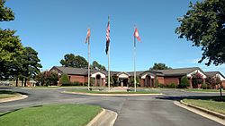
 City Hall | |
| Motto: "Soaring higher" | |
 Location of Jacksonville in Pulaski County, Arkansas. | |
| Coordinates: 34°52′23″N 92°06′55″W / 34.87306°N 92.11528°W | |
| Country | United States |
| State | Arkansas |
| County | Pulaski |
| Founded | 1870 |
| Incorporated | 1941 |
| Area | |
| • City | 28.86 sq mi (74.74 km2) |
| • Land | 28.65 sq mi (74.19 km2) |
| • Water | 0.21 sq mi (0.54 km2) |
| Elevation | 302 ft (92 m) |
| Population (2020) | |
| • City | 29,477 |
| • Density | 1,029.01/sq mi (397.30/km2) |
| • Metro | 729,135 ('14) (Little Rock/North Little Rock) |
| Time zone | UTC-6 (CST) |
| • Summer (DST) | UTC-5 (CDT) |
| ZIP codes | 72076 |
| Area code | 501 |
| FIPS code | 05-34750 |
| GNIS feature ID | 2404781[2] |
| Website | www.cityofjacksonville.net |
Jacksonville is a city in Pulaski County, Arkansas, United States, and a suburb of Little Rock. As of the 2010 census, the population of the city was 28,364.[3] It is part of the Little Rock–North Little Rock–Conway Metropolitan Statistical Area with 729,135 people as of 2014.
- ^ "2020 U.S. Gazetteer Files". United States Census Bureau. Retrieved October 29, 2021.
- ^ a b U.S. Geological Survey Geographic Names Information System: Jacksonville, Arkansas
- ^ "Profile of General Population and Housing Characteristics: 2010 Demographic Profile Data (DP-1): Jacksonville city, Arkansas". United States Census Bureau. Retrieved December 1, 2011.
© MMXXIII Rich X Search. We shall prevail. All rights reserved. Rich X Search

