Back جونسونفيل Arabic جونسونفيل ARZ جانسونویل، گونئی کارولینا AZB Johnsonville (Carolina del Sud) Catalan Джонсонвилл (Къилба Каролина) CE Johnsonville (lungsod sa Tinipong Bansa, South Carolina) CEB Johnsonville, De Carolina Welsh Johnsonville (Carolina del Sur) Spanish Johnsonville (Hego Carolina) Basque جانسونویل، کارولینای جنوبی Persian
Johnsonville, South Carolina | |
|---|---|
 Francis Marion statue at Venters Landing Johnsonville, South Carolina | |
| Motto: "Outpost to the Coast"[1] | |
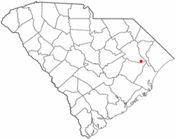
 Location of Johnsonville in South Carolina | |
| Coordinates: 33°49′4″N 79°26′54″W / 33.81778°N 79.44833°W | |
| Country | United States |
| State | South Carolina |
| County | Florence |
| Area | |
| • Total | 2.14 sq mi (5.55 km2) |
| • Land | 2.11 sq mi (5.48 km2) |
| • Water | 0.03 sq mi (0.07 km2) |
| Elevation | 92 ft (28 m) |
| Population | |
| • Total | 1,378 |
| • Density | 651.84/sq mi (251.68/km2) |
| Time zone | UTC-5 (EST) |
| • Summer (DST) | UTC-4 (EDT) |
| ZIP code | 29555 |
| Area code(s) | 843, 854 |
| FIPS code | 45-37105[4] |
| GNIS feature ID | 1223621[5] |
| Website | www |
Johnsonville is a city in Florence County, South Carolina, United States. The population was 1,480 at the 2010 census.[6] It is part of the Florence Metropolitan Statistical Area.
The city was founded in 1913 west of the spot of the former Witherspoon's Ferry on Lynches River, where General Francis Marion received his commission for the Revolutionary War.
- ^ "Welcome to Johnsonville, SC Freeform". www.cityofjohnsonville.com.
- ^ "ArcGIS REST Services Directory". United States Census Bureau. Retrieved October 15, 2022.
- ^ Cite error: The named reference
USCensusDecennial2020CenPopScriptOnlywas invoked but never defined (see the help page). - ^ "U.S. Census website". United States Census Bureau. Retrieved January 31, 2008.
- ^ "US Board on Geographic Names". United States Geological Survey. October 25, 2007. Retrieved January 31, 2008.
- ^ "Geographic Identifiers: 2010 Demographic Profile Data (G001): Johnsonville city, South Carolina". U.S. Census Bureau, American Factfinder. Retrieved August 15, 2016.[dead link]
© MMXXIII Rich X Search. We shall prevail. All rights reserved. Rich X Search