Back Karaj Afrikaans كرج (إيران) Arabic كاراج ARY كرج ARZ Karaj AST Kərəc Azerbaijani کرج AZB Керэдж Byelorussian Карадж Bulgarian কারাজ Bengali/Bangla
Karaj
کرج | |
|---|---|
City | |
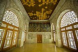
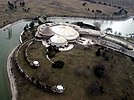
Panoramic, Soleymaniyeh Palace, Taleghani Boulevard, Pearl Palace, Tulips Festival, Amir Kabir dam lake, Aderan Village | |
| Coordinates: 35°49′38″N 50°56′56″E / 35.82722°N 50.94889°E[1] | |
| Country | Iran |
| Province | Alborz |
| County | Karaj |
| District | Central |
| Government | |
| • Mayor | Mehrdad Kiani |
| • City Council Chairman | Javad Chapardar |
| Area | |
| • City | 162 km2 (63 sq mi) |
| Elevation | 1,312 m (4,304 ft) |
| Population (2016)[3] | |
| • City | 1,592,492 |
| • Density | 9,800/km2 (25,000/sq mi) |
| • Urban | 1,973,470 |
| • Metro | 2,512,737[2] |
| • Population Rank in Iran | 4th |
| Time zone | UTC+3:30 (IRST) |
| Area code | 026 |
| Climate | BSk |
| Website | karaj.ir |
Karaj (Persian: کرج; pronounced [kæˈɾædʒ] )[a] is a city in the Central District of Karaj County, Alborz province, Iran, serving as capital of the province, the county, and the district.[5]
Although the county hosts a population around 1.97 million, as recorded in the 2016 census,[3] most of the 1,419 km2 (548 sq mi) county is rugged mountain. The urban area is the fourth-largest in Iran, after Tehran, Mashhad, and Isfahan.[6] Eshtehard County[7] and Fardis County[8] were split off from Karaj County since the previous census.
At the National Census of 2006, Karaj had a population of 1,377,450 in 385,955 households, when it was in Tehran province.[9] The latest census in 2016 counted 1,592,492 people in 508,420 households,[9] by which time the county had separated from the province and become a part of recently established Alborz province.[5]
The earliest records of Karaj date back to the 30th century BC. The city was developed under the rule of the Safavid and Qajar Empire and is home to historical buildings and memorials from those eras. This city has a unique climate due to access to natural resources such as many trees, rivers, and green plains. After Tehran, Karaj is the largest immigrant-friendly city in Iran, so it has been nicknamed "Little Iran."
- ^ OpenStreetMap contributors (17 March 2024). "Karaj, Karaj County" (Map). OpenStreetMap. Retrieved 17 March 2024.
- ^ Alborz downloaded document [dead link]
- ^ a b "Census of the Islamic Republic of Iran, 1395 (2016)". AMAR (in Persian). The Statistical Center of Iran. p. 30. Archived from the original (Excel) on 28 January 2020. Retrieved 19 December 2022.
- ^ Karaj can be found at GEOnet Names Server, at this link, by opening the Advanced Search box, entering "-3069644" in the "Unique Feature Id" form, and clicking on "Search Database".
- ^ a b Larijani, Ali (16 April 1389). "Alborz province establishment law". Lamtakam (in Persian). Guardian Council. Archived from the original on 16 December 2023. Retrieved 16 December 2023.
- ^ City Population: IRAN: Major Cities
- ^ Rahimi, Mohammadreza (10 June 2012). "Eshtehard county was added to the map of country divisions". DOLAT (in Persian). Ministry of Interior, Political and Defense Commission. Archived from the original on 23 September 2015. Retrieved 11 November 2023.
- ^ Rahimi, Mohammad Reza (7 July 2013). "With the approval of the government board: The counties of Fardis, Badreh and Balaveh were added to the map of country divisions". Mehr News (in Persian). Ministry of Interior, Board of Ministers. Archived from the original on 24 March 2023. Retrieved 11 November 2023.
- ^ a b "Census of the Islamic Republic of Iran, 1385 (2006)". AMAR (in Persian). The Statistical Center of Iran. p. 23. Archived from the original (Excel) on 20 September 2011. Retrieved 25 September 2022.
Cite error: There are <ref group=lower-alpha> tags or {{efn}} templates on this page, but the references will not show without a {{reflist|group=lower-alpha}} template or {{notelist}} template (see the help page).
© MMXXIII Rich X Search. We shall prevail. All rights reserved. Rich X Search


