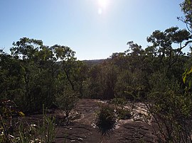
| Kariong Central Coast, New South Wales | |||||||||||||||
|---|---|---|---|---|---|---|---|---|---|---|---|---|---|---|---|
 | |||||||||||||||
 | |||||||||||||||
| Coordinates | 33°26′24″S 151°18′04″E / 33.440°S 151.301°E | ||||||||||||||
| Population | 6,485 (2021 census)[1] | ||||||||||||||
| Postcode(s) | 2250 | ||||||||||||||
| Elevation | 192 m (630 ft) | ||||||||||||||
| Location | |||||||||||||||
| LGA(s) | Central Coast Council | ||||||||||||||
| Parish | Patonga | ||||||||||||||
| State electorate(s) | Gosford | ||||||||||||||
| Federal division(s) | Robertson | ||||||||||||||
| |||||||||||||||
Kariong (/kærɪɒŋ/) is a locality of the Central Coast region of New South Wales, Australia west of Gosford along the Central Coast Highway. It is part of the Central Coast Council local government area.
- ^ Australian Bureau of Statistics (28 June 2022). "Kariong". 2021 Census QuickStats. Retrieved 16 May 2024.
 Material was copied from this source, which is available under a Creative Commons Attribution 4.0 International License.
© MMXXIII Rich X Search. We shall prevail. All rights reserved. Rich X Search

