Back غابات كايا ميجيكندا المقدسه ARZ Montes sagraos de kayas de los Mijikenda AST Mijikenda tumtaf aalxoeem AVK Kaya (Micikenda) Azerbaijani Кая (святы гай) Byelorussian Кая (сьвяты гай) BE-X-OLD Boscos sagrats de kayes dels mijikenda Catalan Mijikendafolkenes hellige skove Danish Kaya (Heiligtum) German Bosques sagrados de kayas de los mijikenda Spanish
| UNESCO World Heritage Site | |
|---|---|
 | |
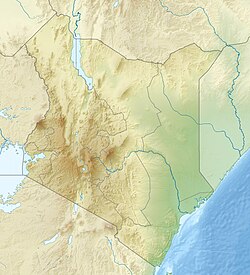
| Location | Coast Province, Kenya |
| Includes | Kaya Giriama
Kaya Jibana Kaya Kambe Kaya Kauma Kaya Ribe The Rabai Kayas The Duruma Kayas Kaya Kinondo Kaya Chonyi |
| Criteria | Cultural: iii, v, vi |
| Reference | 1231rev |
| Inscription | 2008 (32nd Session) |
| Area | 1,538 ha (3,800 acres) |
| Coordinates | 3°55′55″S 39°35′46″E / 3.93194°S 39.59611°E |
| History of Kenya |
|---|
 |
|
|
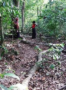
A kaya (plural makaya or kayas) is a sacred site of the Mijikenda people in the former Coast Province of Kenya. Often located within sacred forests, a kaya is considered to be an intrinsic source of ritual power and the origin of cultural identity;[1][2] it is also a place of prayer for members of the Mijikenda ethnic group.[3] The settlement, ritual centre, and fortified enclosure associated with the forest are also part of the kaya. In the present day, the kaya is also referred to as a traditional organizational unit of the Mijikenda.[4] Eleven of the approximately 60 separate makaya have been grouped together and inscribed as the Sacred Mijikenda Kaya Forests, a UNESCO World Heritage Site.
- ^ Parkin 2006, p. 37.
- ^ Wynne-Jones, Stephanie; Laviolette, Adria, eds. (2017). The Swahili World. doi:10.4324/9781315691459. ISBN 978-1-315-69145-9.[page needed]
- ^ Nyamweru, Celia (Fall 1996). "Sacred Groves Threatened by Development: The Kaya Forests of Kenya". Cultural Survival Quarterly. "Who's Local Here?" Politics of Participation in Development. 20 (3). Retrieved 14 December 2013.
- ^ Buluma, Rodgers (July 2, 2013). "The elderly targeted for murder". News24. Retrieved 15 December 2013.
© MMXXIII Rich X Search. We shall prevail. All rights reserved. Rich X Search
