Back কাঞ্চনজংঘা ৰাষ্ট্ৰীয় উদ্যান Assamese কাঞ্চনজঙ্ঘা জাতীয় উদ্যান Bengali/Bangla Národní park Kančendženga Czech Kangchendzönga-Nationalpark German Parque nacional de Khangchendzonga Spanish پارک ملی خانگچندزونگا Persian Khangchendzongan kansallispuisto Finnish Parc national de Khangchendzonga French הפארק הלאומי קנצ'נדזונגה HE कंचनजंगा राष्ट्रीय उद्यान Hindi
| Khangchendzonga National Park | |
|---|---|
 | |
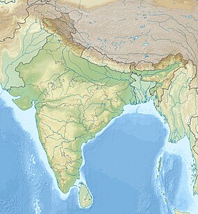
| Location | Mangan district and Gyalshing district, Sikkim, India |
| Nearest town | Chungthang |
| Coordinates | 27°39′22.7″N 88°18′44.3″E / 27.656306°N 88.312306°E |
| Area | 1,784 km2 (689 sq mi) |
| Established | 1977 |
| Governing body | Ministry of Environment and Forests, Government of India |
| Type | Mixed |
| Criteria | iii, vi, vii, x |
| Designated | 2016 (40th session) |
| Reference no. | 1513 |
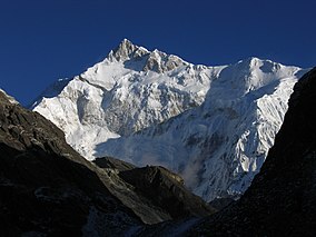
Khangchendzonga National Park, also Kanchenjunga Biosphere Reserve, is a national park and a biosphere reserve located in Sikkim, India. It was inscribed to the UNESCO World Heritage Sites list in July 2016, becoming the first "Mixed Heritage" site of India.[1] It was included in the UNESCO Man and the Biosphere Programme. The park is named after the mountain Kangchenjunga, which is the third-highest peak in the world at 8,586 m (28,169 ft) tall. The total area of the park is 849.5 km2 (328.0 sq mi).
- ^ O'Neill, A. (2017). "Sikkim claims India's first mixed-criteria UNESCO World Heritage Site" (PDF). Current Science. 112 (5): 893–994. Archived (PDF) from the original on 29 March 2017. Retrieved 11 May 2017.
© MMXXIII Rich X Search. We shall prevail. All rights reserved. Rich X Search

