| Kwale Island | |
|---|---|
| Location | Tanga Region, Mkinga District, Kwale ward |
| Nearest city | Tanga |
| Coordinates | 4°58′12″S 39°9′36″E / 4.97000°S 39.16000°E |
| Length | 4.4 km (2.7 mi) |
| Width | 3.4 km (2.1 mi) |
| Established | 2010 |
| Governing body | Marine Parks & Reserves Authority (Tanzania) |
| Website | Tanga Coelacanth Marine Park |
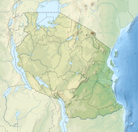
Kwale Island (Kisiwa cha Kwale, in Swahili) is a protected, seasonally inhabited island in the Pemba Channel under the Tanga Marine Reserves (TMRS) with the IUCN category II located inside Kwale ward in Mkinga District of Tanga Region in Tanzania. The coral island, located approximately a kilometer offshore in Manza Bay, and the modern hamlet on the shoreline are both referred to as Kwale. 86.2% of Kwale Island, or 528.1 Ha, is covered with mangroves. Kwale Island and Ulenge Island are the only seasonally inhabited by islands in the marine reserve, thus the two have the most human impact.[1][2] The Island has an average elevation of 7 m (23 ft).[3]
- ^ Muhando, C. A. "Biophysical Features in the Northern Tanga Marine Reserves, Tanzania." Marine Parks and Reserves Unit, Dar es Salaam, Tanzania. vi (2011).
- ^ "Tanzania:Coastal Zone Tanzania (Districts and Wards) – Population Statistics, Charts and Map".
- ^ "Kwale Island, Mkinga elevation".
© MMXXIII Rich X Search. We shall prevail. All rights reserved. Rich X Search

